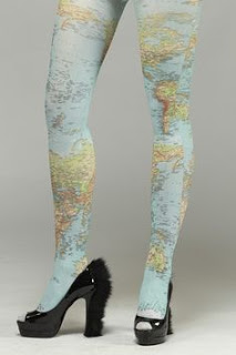
As analogies go, comparing Ordnance Survey Explorer 213 against a black lace thong, half cup bra or red satin suspender belt might be stretching things a little, however, I honestly believe certain similarities exist between lingerie and maps that are hard to dismiss.
Those of you who already love maps, probably don’t need me to tell you that there’s often much more to them than a collection of symbols, shading and lines. At first glance, a single grid square will furnish you with a very accurate understanding of what you’re likely to encounter should you decide to travel through it. Contour lines will enable you to see whether you’ll be joyfully freewheeling down or cursing a push up. You’ll know to expect water, perhaps a river or just a stream and you’ll also know if wading and wet feet are called for or if a bridge exists to ease your progress.
Should you choose to ride across this (or any other) 1000 meter by 1000 meter square, the map will show you the available options. It might be a yellow line indicating easy rolling tarmac, a green dash showing a right of way for both, the self propelled two wheel traveller and those with four hoofs or perhaps, a line of crosses showing a byway open to one and all? You might even be tempted by the cheeky lure of something smaller and foot friendly or the seemingly identical and never ending fire-road, that snakes through forests across the country.
What about buildings? They’ll all be outlined on your trusty map, a farm, an abandoned barn high in the hills or a place of worship both licensed and otherwise. If there’s trees, you’ll know whether they’re dense, regimented rows of conifers or something a little more homegrown and natural. If you’re paying attention, then fences, walls and ditches can be anticipated and used to your advantage and a steep scree slope or impassable rock face should never come as a surprise.
Indicators of mans longstanding interaction with the land are obvious. Monuments to industry like quarries, shafts and mines are all marked although the physical scars may have nearly healed completely. Monuments of a different kind, older and more mysterious aren’t forgotten either, their locations pin-pointed as accurately as within any history text book.
All of this detail is what makes maps fantastic, each one holds the potential for countless trips, rides and adventures, all you need are the skills to interpret them. Really, I’ve just skimmed the surface of the possible information you can glean from any Ordnance Survey Explorer … each one holds much more. However, the best things on a map are those which aren’t there, the things the map doesn’t fully reveal – you could perhaps call them, ‘the special bits’. A map may point you towards these things but it can’t show you the exact location of the perfect overnight spot. It might guide you to the waters edge but it can’t tell you where along the river bank you’ll see an otter fishing. Navigating your way to the top of a mountain is relatively straightforward but being there to witness a spectacular sunset is all together different. No, these special things will only be revealed to you when the time is right. You’ve stared at the curves and contours on the paper for days wondering what might be hidden within them but only after your anticipation has been fuelled by your imagination, will you get to see everything.

Genius……. are those 'leggings' available at the WRT? 🙂
I'll see what I can do – hold-up's, stockings or tights?
Think of the weight saving