Hello and congratulations on finding part 2 of the Bear Bones guide to maps and stuff – that in itself must surely prove that part 1 was a great success – perhaps? We’ll continue in part 2 with more random map related stuff that I’m afraid isn’t really in any particular order but just happened to filter from my brain to here.
How much further?
We know that each square on our map represents 1km across and up – don’t we? If you rode from one side of the square to the other in a perfectly straight line (and it was flat) you’d have ridden a solitary, single kilometre. Tracks, roads and things don’t tend to follow truly straight lines though, even the Romans with their straight line fetish deviated when terrain or circumstance required.
Knowing how far away we are from something is very useful. It might be a water source, a junction or split in the track or it might be the only pub in a thirty mile radius. When you’re sat at home in front of your computer with your favourite mapping software, calculating how far it is from one point to another is simple because your lovely software will tell you and usually, it’ll be fairly accurate. Sadly, you probably haven’t got that luxury out in the hills have you? Oh you have? Well, just let’s pretend that you haven’t shall we? When someone starts their sentence with “How much further to …” and their voice is just on the verge of sounding whiny, then you’re going to have to tell them something and in my experience an outright lie or random guess will always backfire; something based on fact is usually much better if you want to avoid “but you said it was only …” an hour later.
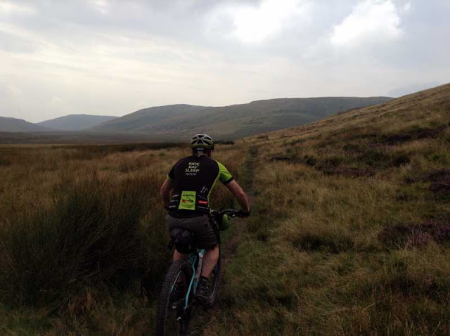 |
| Here’s Mike, probably wondering just how long Bugilyn goes on for. |
Thankfully, we probably don’t need to be ‘that’ accurate and a ballpark figure will usually suffice. You could carry one of those little map measuring wheel things but using one with any accuracy on a windswept hillside at midnight (in the rain obviously) will be akin to trying to do your neatest colouring in while operating a pneumatic drill. No, we need something much quicker and if you can count without the use of fingers then that’s all you need.
Simply ….. locate the point on the map where you are now. Then, locate the point where you want to be. Now, count how many grid squares your intended route passes through. The total number of squares will equal the total number of kilometres. I’m sure that probably sounds like rubbish and rather haphazard but in most cases I find it’s usually within ten or at worst, twenty percent of the actual distance. Obviously the longer the distance the more accurate it appears or perhaps better to say, the less inaccurate it appears because 53km sounds a lot like 50km but 6km is quite different to 3km.
Something else you can do is to transform yourself into your very own map measuring tool – really? Yes. Have you got any idea how wide your index finger is? I suggest you measure it then knowing that each square on your 1:25k map measures 40mm x 40mm work out what that represents on the map. My finger may look quite dainty but is actually 400m wide when I lay it on the map. The truly adventurous can experiment with other body parts if they wish but just remember that on occasion, the temperature can effect the size of our appendages somewhat.
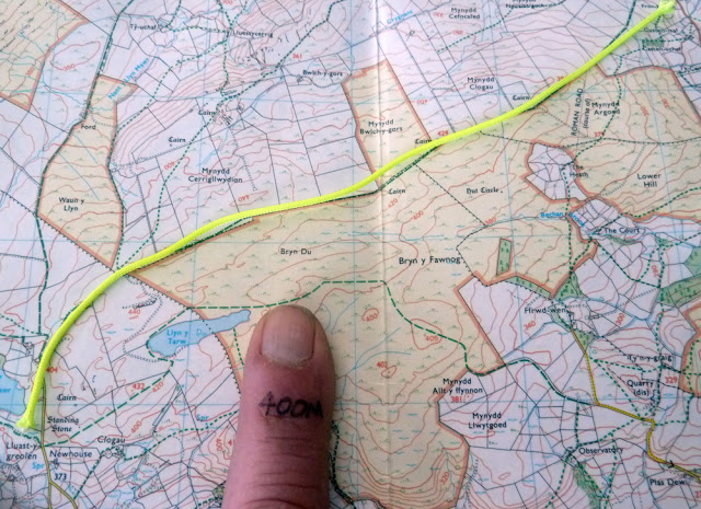 |
| String and finger tip. Two handy ways of helping work out when you might get to where you’re going. |
If you require a little more accuracy than the ‘quick reckoning’ above, then use a short length of thin cord. Place it on the map following whatever torturous route you’ve devised. Hold it at each end and pull it straight across your map using the grid squares to determine how many kilometres it is – you could even mark the cord at 1km intervals if you wanted but DON’T use elasticated cord.
Be aware that none of those techniques take into account any additional distance created by going up and down. The hillier your route, the less accuracy there will be and the greater the distance.
But how long will it take?
Once you know how far you have to travel you can begin to estimate (okay guess) how long it’s likely to take. In truth experience is your best guide as you’ll no doubt have a reasonable idea based on past rides but if you want something to work with, then my experience would suggest 10km per hour makes a good starting point. However, there are a few caveats that apply. Firstly, it assumes that you are riding a lightly loaded (remember kids TLS) mountain bike off-road. It is also a total average not simply a moving average so it takes into account stopping to open gates, putting your jacket on, taking it off again, etc. Finally, it assumes that you aren’t on fresh legs and chasing KoM but are riding a reasonable distance over a number of days, or at least having a big day out. As with the quick distance calculations, it’s not science and it’s by no means wholly accurate but it will give you a very good indication of your likely eta.
Can you see the sea yet?
Knowing what you’re likely to see and experience and when it’s likely to happen, can be a great asset when it comes to not getting lost. It doesn’t require in-depth research or hours of study; a quick cursory glance at the map should furnish you enough information to know what lies ahead. You could consider it a mental tick list which will help keep you on route.
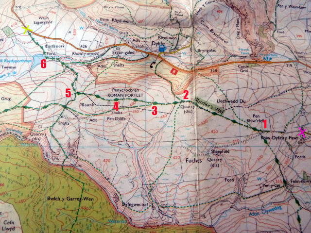 |
| Obviously maps don’t include those little numbers but they provide all the information you need. |
Let’s imagine that we’re riding the track above between the two points marked X and we’re traveling east to west. 1/ After 1/2km or so there’s a track on the left but we remain straight ahead – even if the track on the left looks more frequently used or the more obvious track, don’t take it 2/ It’s a gradual climb up to point 2 where there is a bridleway leading off to the right which heads downhill. It’s about 1km from point 1. 3/ Another bridleway on our left, however it’s only marked as a RoW and there’s no physical track indicated, so there may be no visible sign on the ground. 4/ We’ve reached the top of the climb after about 2km and will now start to descend. 5/ We arrive at a T junction. We turn right coming of a restricted byway onto a BOAT – chances are it’ll be very similar but remember that you might now encounter motorised vehicles. Our track is now predominantly downhill. After a few hundred metres, there’s a bridleway on our left (probably no actual track present) and another bridleway on the right which is likely to be a physical track. 6/ Reach a ford with a small lake / pond on our left and from here the track begins to climb again until we reach X. If the ford proves too difficult to cross, turn around and take the bridleway that’s now on your left. Join the tarmac road and turn left to rejoin your route … or turn right and head for the pub.
None of that is complicated and it can all be gleaned from a brief look at a paper map or gps screen but those simple waymarks could save you an awful lot of wasted time and backtracking.
What’s wrong with 1:50K?
You may be wondering why I’m focusing on 1:25k scale maps rather than the ever popular 1:50k scale – you’re not? Oh well, I’ll explain anyway. It should be obvious by the scales themselves that the 1:25k OS Explorer series offers much more scope for additional detail and when you’re planning your next trip into the deepest depths of nowhere, detail can make a profound and welcome difference.
While having things like fences / walls and the names of farms won’t make route planning any easier, it will make extracting yourself from the mire far easier should you find yourself temporarily displaced. Farm names probably don’t require much explanation – most occupied farms will display their name, just match the name on the map to that on the sign and you’ll know exactly where you are; even if it’s not where you’re meant to be.
Walls and fences? Just like any other prominent feature a boundary provides another clue as to where you are but they can also be pressed into service as a ‘handrail’ to help guide you should you find yourself lost – especially in poor visibility and on predominantly featureless / trackless terrain. ‘Hitting’ a fence and following it until you reach a recognisable feature such as a bridge, track, woods, etc, etc can be a great aid to relocation – but just make sure you’re following it in the right direction.
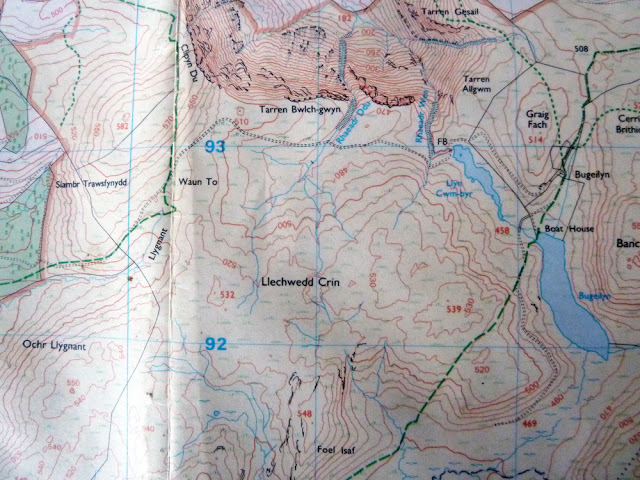 |
| Just a common or garden 1:25k OS map. |
Something else occasionally omitted from 1:50k maps are complete sections of track. That’s right, there are instances where a few kilometres of track may not appear at all. As you can imagine the disappearance of an entire track can be somewhat of an inconvenience for both route planning and ‘on the ground’ navigation.
If you look at the section of 1:25k map above then you shouldn’t spot anything unusual.
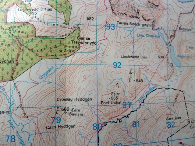 |
| Same map, different scale but there’s something missing. |
Now look at the same section of map but this time it’s a 1:50k version. Again, you probably won’t notice anything odd – same bridleways, hills, lakes and rivers.
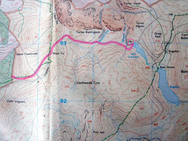 |
| Aha, the ‘Lost track of Bwlch-gwyn’. The source of the Nile was easier to find. |
Perhaps this highlighted version of the 1:25k will help? On the 1:50k the track from the east stops just about where I’ve put a box around the footbridge, yet there’s clearly a track marked here and a jolly nice track it is too. If you were trying to join east to west or vice versa relying purely on the information contained on the smaller scale map, you have but one option – Bugeilyn. If you recall what I said about bridleways in part one then you should remember that I mentioned how a RoW without black dashes beneath it may well not be a track at all … that is Bugeilyn, it’s boggy, it’s wet and it’s largely pathless. NOTE – although not shown, the track in question is actually permissive, so even the 1:25k won’t always get everything right.
Well, I think that’s enough for today. I shall return with part 3 before long in which amongst other things, we will have a look at maps made by somebody else.
Why no mention of electronic maps coupled to a phone/gps?
Nothing quite as reassuring as knowing exactly were you are and which direction you are heading in.
Nothing quite as reassuring as having an actual paper 1:25000 map and obvious landmark ("Does that church on the horizon have a spire or a tower kids?") oh and a compass. Batteries and signal not required 😉
Nothing quite as reassuring as only going out to play in fine weather!
I have assumed this because it is clear you have never had a paper map slowly disintegrate on a wet day and finally blow away in small pieces in a strong wind. (Yes it was in a waterproof holder but it had to come out into the wet several times to be refolded to keep the route visible)
When this happened to me I was also in cloud/mist with visibility of about 100 yards. Being able to see a horizon, church or no church would have been luxury.
The maps on my phone are OS 1:25000 scale (but I use the 1:10000 scale maps on roads)
No signal is needed to use these maps and battery power is no problem, even on multi-day trips.
Maps are maps whether they be printed on paper or displayed on a screen. The information is relevant to both but I do think the overview offered by paper maps can be a big help to those finding their feet with navigation.