Long, long ago, in a land not far from here, there existed a network of roads that criss-crossed the countryside joining farm to hamlet and village to town. They conveyed the righteous toward salvation, eased the passage of animals and goods, kept the news and gossip flowing and transported the bodies of the deceased from homestead to grave. Time marched quietly alongside the traveller of these roads. Each generation of foot, hoof and wheel echoed the previous one, every step and revolution helping drive the track deeper down through soil and rock to form an indelible, sunken tattoo on the landscape, hundreds of years in the making.
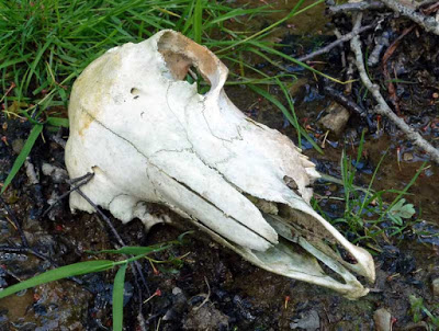 |
| Not everyone makes it back. |
With time comes progress … as horse power gave way to horsepower and the motorised revolution gained momentum, many of these roads found their usefulness gradually diminish until they eventually passed from memory. However, some were more fortunate than others, with surfacing and widening a number had their status elevated and their appearance changed beyond recognition. A few found work and occasionally, even notoriety within a fledgling outdoor leisure industry but in many instances, they were simply left to die – earth to earth, ashes to ashes.
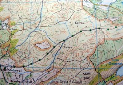 |
| This is what it might look like on the map … |
I know what you’re thinking … ‘very interesting but what’s all that got to do with me?’ or perhaps just, ‘what’s that got to do with me?’. Either way, as an intrepid bikepacker the above could potentially have a lot to do with you. While most of these roads are dead and largely forgotten, the slowly decaying corpses of many still remain and in some cases, their whereabouts are recorded on present day maps. Before you get too excited, I should just point out that they’re not always the easiest things to spot amidst the array coloured dashes and squiggles adorning used by Ordnance Survey. Two thin black lines lying side by side indicating fence, hedge or wall are the tell tale signs on paper. If you’re particularly lucky, there’ll be a series of green dots sandwiched between these constraints, besides making the things easier to spot, these dots mean that any exploration you embark on is above board … and if they’re not present? Well, then it’s a gamble and common sense should hold sway.
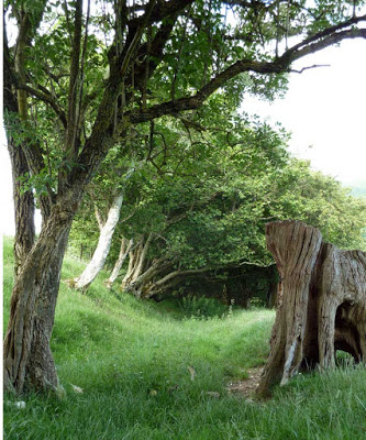 |
| All the signs are there but you won’t find it on any modern map. |
When you begin your search, try and imagine what the world might have looked like a hundred, two hundred or more years ago. Places which now appear devoid of human activity may well not have been. Look for tarmac roads linking villages, they’ll often stick to the low ground and follow the path of least resistance but an older, more direct route may exist in close proximity. Any two points that people needed to join all have potential … abandoned quarries, mine workings, old pubs and churches can all help point you in the right direction. Reproduction OS maps (they go by the name Cassini) from the 1800’s can prove a valuable ally in your paper quest and will often help confirm your suspicions and clarify any speculation.
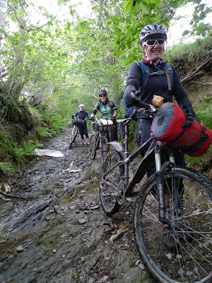 |
| Very steep, very rocky and very, very slippery – what’s not to like? |
For every road the modern map portrays, there’s probably three or more it doesn’t. These can only be found with a combination of time, chance and inclination. A line of twisted, gnarled trees might have once been a hedge laid to define a road and prevent animals from straying off it. What now looks like a wide, overgrown ditch could have been a road linking a series of farms and a lonely stand of Scots Pine trees, might have once pointed drovers in the direction of a safe river crossing or inn … and speaking of inns, pub names can often help pin-point something of interest – the Drovers Arms and the Black Bull weren’t called that for nothing. One thing those who walked these roads weren’t generally scared of, was hills. They seemed to hold a firm belief that the shortest and therefor fastest way between two points was a straight line … even if it involved a 1 in 4 gradient. It’s not uncommon to find a more meandering, modern track in very close proximity to something much older and much steeper.
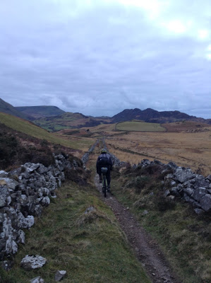 |
| … and this is what it looks like from your bike. |
If you have the inclination and are willing to invest some time, the rewards can be great and occasionally unexpected. It’s also true to say, that you’ll likely spend quite a few hours chasing the wildest of geese while you search for new riding opportunities. Try to temper any potential disappointment with the thought that ghost roads are out there, spread across the country and when you find a good example, the effort will be well worth it … break out the maps, get on your bike and go and have a look, you might be surprised by what you find.
Next time, I’ll try and convince you to go in search of Bwlchs … it’ll be great, you’ll love it.


I read somewhere that drove roads in Scotland followed the best pasture rather than the most direct route.
Could be true Ray, although I doubt they'd have stopped much for grazing during the day … time being money and all that.
On the contrary, they kept it slow on the drove roads so that the animals didn't lose weight or condition on the way.
Average speed of 2 miles an hour. North Wales to Kent was considered a 3 week trip … so not that slow.