
I have now updated the route to its final format and this is it. It is in four parts.
http://www.mapmyride.com/routes/view/1081918156
http://www.mapmyride.com/routes/view/1081919174
http://www.mapmyride.com/routes/view/1081919706
http://www.mapmyride.com/routes/view/1081920316
I have mapped the best line along the Thief's Road but feel a little explanation may help. The Thief's Road is encountered early on after climbing the landrover track from Megget reservoir.
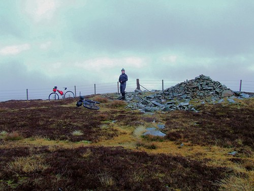
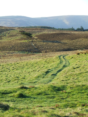
After descending from the saddle between Dollar Law and Fifescar Knowe keep left of a small rock outcrop and head for a wooden signpost. Bear right down a small dip to cross the fence line then rejoin the obvious path up the side of Long Grain Knowe. At the top follow the right side of the fence line to a gate, go through the gate and follow the left side of the fence line downhill to a small mound with a sunken stony centre then rejoin the main path.
If you want the gpx direct from me then email me at borders350ittATgmailDOTcom
Please say if you want just the gpx or to be included in the group start on the first weekend of July each year, applications taken from March 1st each year.
Facebook Group - https://www.facebook.com/groups/517013845127454/
Borders 350 The Finalised Route
Moderators: Bearbonesnorm, Taylor, Chew
Borders 350 The Finalised Route
Last edited by Ray Young on Thu May 26, 2016 12:42 pm, edited 6 times in total.
-
fatbikephil

- Posts: 7385
- Joined: Wed Apr 02, 2014 10:51 pm
- Location: Fife
- Contact:
Re: Borders 350
Is this "It"? Looks good Ray, are you able to send out GPX's?
Phil
Phil
Re: Borders 350
Hi Phil, hoping this is it, final bit to ride this Thursday. Email me at youngray50ATgmailDOTcom and I'll send them out.htrider wrote:Is this "It"? Looks good Ray, are you able to send out GPX's?
Phil

-
fatbikephil
- Posts: 7385
- Joined: Wed Apr 02, 2014 10:51 pm
- Location: Fife
- Contact:
Re: Borders 350
I did try that but registering seemed to defeat me... I'll drop you an email Ray
Cheers
Phil
Cheers
Phil
Re: Borders 350 The Finalised Route
The route in pictures.
The side of Orchard bicycle looking to Birks Hill.
 Borders 001 by youngray50, on Flickr
The top of Birkscairn Hill.
 2012_1215biviscotland0011 by youngray50, on Flickr
Above Glenshiel Banks. The Capital Trail climbs up to this path a little further along.
 Borders 002 by youngray50, on Flickr
St Mary's Loch.
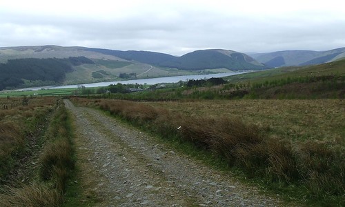 Borders 004 by youngray50, on Flickr
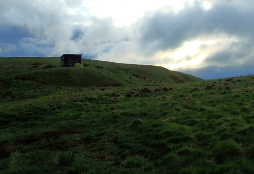
Tower at Whitehope, open to the public and you can climb to the top.
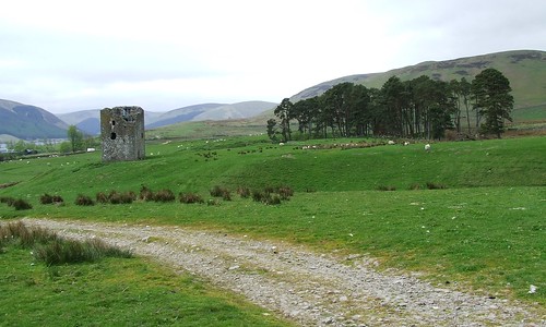 Borders 005 by youngray50, on Flickr
Megget Reservoir at sunrise.
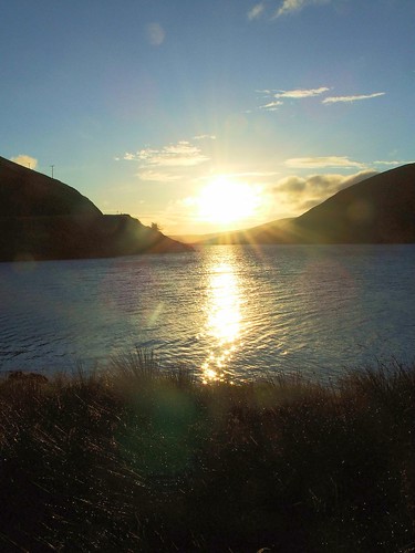 3 days in The Borders 018 by youngray50, on Flickr
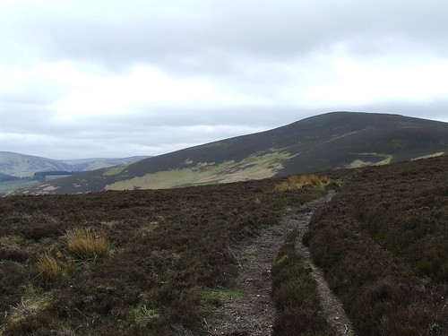
One third of the way up the 390 metre climb from Megget Reservoir on the way to Dollar Law. This track was rideable all the way once but parts of it have had a rough stone top dressing applied making those parts difficult to ride now.
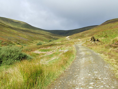 3 days in The Borders 023 by youngray50, on Flickr
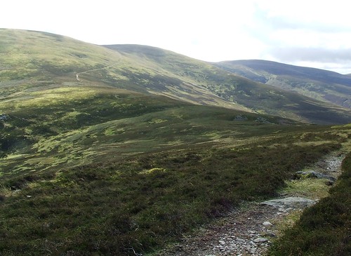
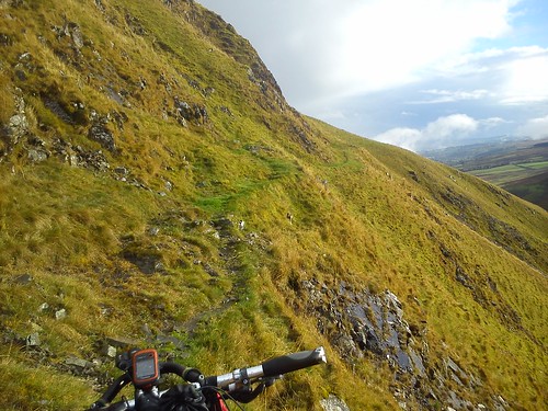
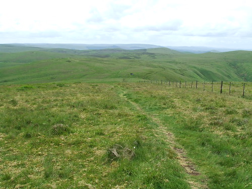
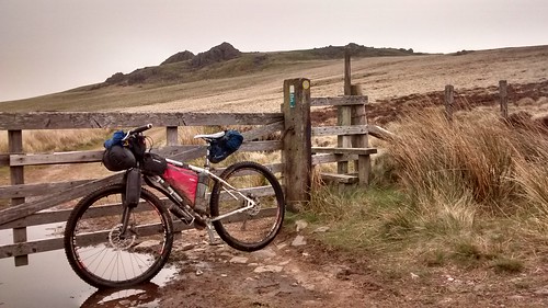
Looking back down at Megget Reservoir from the point we leave the land rover track but still a little bit to climb yet.
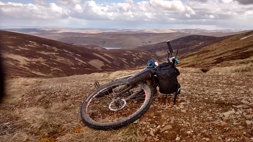 161 by youngray50, on Flickr
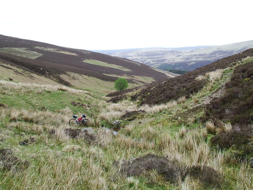
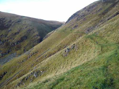
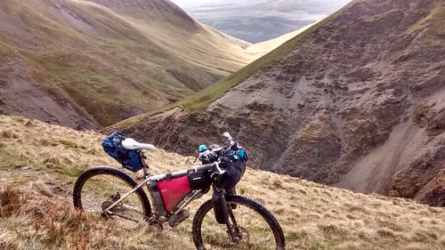
Looking back at Thief's Road descending from the saddle between Dollar Law (left) and Fifescar Knowe (middle). The path is good in the foreground but the descent has two dodgy boulder strewn ruts cut into from centuries of use by horse drawn carts. The ruts are not continuous and are often hidden by grass, you have been warned.
 3 days in The Borders 028 by youngray50, on Flickr
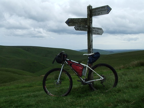
Broughton Heights.
 Broughton Heights 011 by youngray50, on Flickr
 Broughton Heights 006 by youngray50, on Flickr
I would love to have been able to include this in the route, Step Cut Path on the Eastern flank of The Devil's Beeftub which gives the best views of it. It also has a small scary scramble with a big drop to the side. It's not included as the path leads you right through several houses with gates not far ahead, riders would be passing this point late in the evening or through the night on the first day or early in the morning of the second day and I think this would annoy the residents a fair bit. Still good views from the circumnavigation of The Devil's Beeftub though.
 Beeftub 023 by youngray50, on Flickr
 Beeftub 020 by youngray50, on Flickr
Between Moffat and Overpawhope Bothy on the Southern Upland Way.
 164 by youngray50, on Flickr
Spithope Bothy. A fantastic little bothy but very popular as it is easily accessed from the road. A bit of a pain dragging a loaded bike down the bank to and from it even if it is only a short distance . Sleeps 4, 6 if cosy, possibly 8 with 2 on the floor.
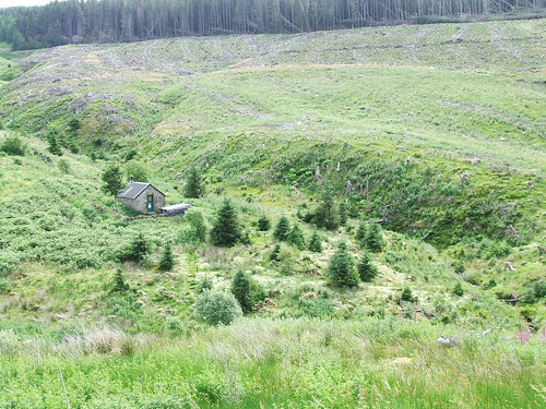 cheviots 002 by youngray50, on Flickr
 cheviots 001 by youngray50, on Flickr
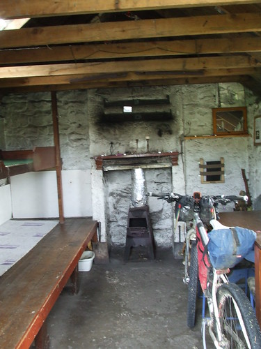
Yearning Saddle Refuge Hut by Lamb Hill about 10 miles further on from Spithope Bothy. Again not big and on the Pennine way so often in use.
 2013_0622sol0002 by youngray50, on Flickr
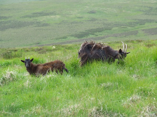
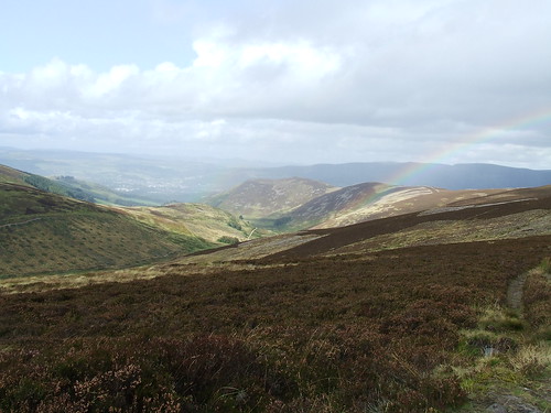
The Cheviot Hills Ridgeline and goats. There are now two herds up here, this lot take no notice of you whilst the other group led by a big billy goat move off as soon as spotting or scenting you.
 cheviots 009 by youngray50, on Flickr
 cheviots 010 by youngray50, on Flickr
 cheviots 008 by youngray50, on Flickr
Langlee Crags after Wooler.
 166 by youngray50, on Flickr
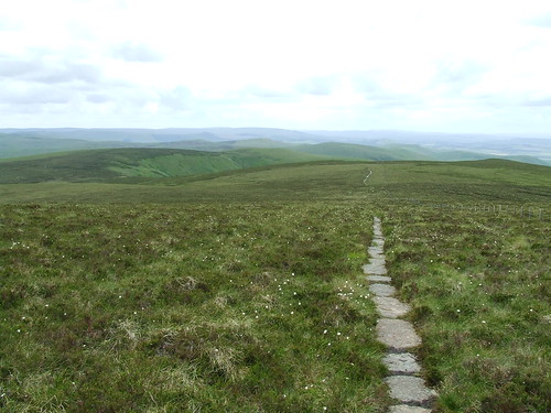
The crossover point in The Cheviots and The Street.
 cheviots 013 by youngray50, on Flickr
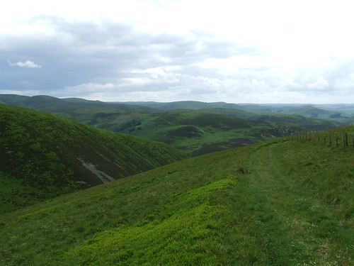 cheviots 016 by youngray50, on Flickr
Gypsy Glen, the final descent down the ridgeline to the right.
 3 days in The Borders 013 by youngray50, on Flickr
The side of Orchard bicycle looking to Birks Hill.
Borders 001 by youngray50, on FlickrThe top of Birkscairn Hill.
2012_1215biviscotland0011 by youngray50, on FlickrAbove Glenshiel Banks. The Capital Trail climbs up to this path a little further along.
Borders 002 by youngray50, on FlickrSt Mary's Loch.
Borders 004 by youngray50, on FlickrTower at Whitehope, open to the public and you can climb to the top.
Borders 005 by youngray50, on FlickrMegget Reservoir at sunrise.
3 days in The Borders 018 by youngray50, on FlickrOne third of the way up the 390 metre climb from Megget Reservoir on the way to Dollar Law. This track was rideable all the way once but parts of it have had a rough stone top dressing applied making those parts difficult to ride now.
3 days in The Borders 023 by youngray50, on FlickrLooking back down at Megget Reservoir from the point we leave the land rover track but still a little bit to climb yet.
161 by youngray50, on FlickrLooking back at Thief's Road descending from the saddle between Dollar Law (left) and Fifescar Knowe (middle). The path is good in the foreground but the descent has two dodgy boulder strewn ruts cut into from centuries of use by horse drawn carts. The ruts are not continuous and are often hidden by grass, you have been warned.
3 days in The Borders 028 by youngray50, on FlickrBroughton Heights.
Broughton Heights 011 by youngray50, on FlickrBroughton Heights 006 by youngray50, on FlickrI would love to have been able to include this in the route, Step Cut Path on the Eastern flank of The Devil's Beeftub which gives the best views of it. It also has a small scary scramble with a big drop to the side. It's not included as the path leads you right through several houses with gates not far ahead, riders would be passing this point late in the evening or through the night on the first day or early in the morning of the second day and I think this would annoy the residents a fair bit. Still good views from the circumnavigation of The Devil's Beeftub though.
Beeftub 023 by youngray50, on FlickrBeeftub 020 by youngray50, on FlickrBetween Moffat and Overpawhope Bothy on the Southern Upland Way.
164 by youngray50, on FlickrSpithope Bothy. A fantastic little bothy but very popular as it is easily accessed from the road. A bit of a pain dragging a loaded bike down the bank to and from it even if it is only a short distance . Sleeps 4, 6 if cosy, possibly 8 with 2 on the floor.
cheviots 002 by youngray50, on Flickrcheviots 001 by youngray50, on FlickrYearning Saddle Refuge Hut by Lamb Hill about 10 miles further on from Spithope Bothy. Again not big and on the Pennine way so often in use.
2013_0622sol0002 by youngray50, on FlickrThe Cheviot Hills Ridgeline and goats. There are now two herds up here, this lot take no notice of you whilst the other group led by a big billy goat move off as soon as spotting or scenting you.
cheviots 009 by youngray50, on Flickrcheviots 010 by youngray50, on Flickrcheviots 008 by youngray50, on FlickrLanglee Crags after Wooler.
166 by youngray50, on FlickrThe crossover point in The Cheviots and The Street.
cheviots 013 by youngray50, on Flickrcheviots 016 by youngray50, on FlickrGypsy Glen, the final descent down the ridgeline to the right.
3 days in The Borders 013 by youngray50, on Flickr