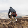
I need to get out, properly.. soon.. but at the moment a long bike ride carrying kit in the hills is against Dr's advice. So I'm going for a walk instead. Got all I need into a fairly small rucksack, the benefits of good bivi kit. Have some good boots and a hiking pole that will prop up the Gatewood cape. Add a brikka coffee pot for a bit of luxury and a book, sorted.
Any recommendations for a long distance walk? Ideally in Wales with some big hill views. 4-7 days. I could cover 25-30 miles of Ridgeway type path in a day comfortably enough.
Offa's Dyke could be good and I have a lovely hand-drawn guidebook I found in a SH bookshop. May be a bit long for my first hike like this in ages and max 7 days available, but no need to do all of it.
Snowdonia slate trail looks good, good mix of history and views from what I can see and no high mountains either (which I’m not sure is a good thing!). Can easily add a few summits along the route though
Starts in Bangor but for me, I’d start in Betws Y Coed and miss out the little Bangor section
Also worth thinking about coastal routes. Having done various bits of Dorset and south Devon coast, and Pembrokeshire, spending some days walking a decent section of coastline really appeals. I also get the lure of the hills and mountains. But there is lots of interest and beauty on rugged coastlines, and wildlife, and weather. It's also surprisingly difficult as there's lots and lots of sharp ups and downs, and lots of nadgery paths in general. You get the advantage of chips resupply and public toilets at tourist honeypots, but there are loads of quieter in-between pieces with hidden coves, glorious tangled undercliffs ideal for a wild camp - as well as inland diversions of all kinds. Oh, and the option for a swim if it's hot! For me, these kind of trails would be a push to do 25-30 miles a day - and you probably wouldn't want to.
Pembrokeshire coast is stunning, and chock full of seals and seabirds; Whitesands bay is probably my most beautiful beach i've seen. It's got lots of nice low, wind-blown scrubby-ness to some of the trails, from memory.
South West Coast Path, Jurrasic coast Sandbanks/Poole - Lyme Regis or beyond: Very popular walking route, and some honeypots along the way, but it is utterly stunning, and between sandbanks and Weymouth, lots of ups and downs. But there are so many gems that it is worth it in my opinion. Lots of undercliff/hinterland options to set up wild camps too.
South West Coast Path, North Devon, Minehead - westward: Not walked much of this, but have holidayed in the area a few times, and the coastline is stunning and hilly, and well worth a go. You could even loop it round back via Exmoor.
The SWCP covers so much coast, and i'm sure many other highlights in other parts, but the above are excellent and easy to get to...
faustus wrote: ↑Tue Feb 04, 2025 10:48 am
... lots of interest and beauty on rugged coastlines, and wildlife, and weather. It's also surprisingly difficult as there's lots and lots of sharp ups and downs, and lots of nadgery paths in general. You get the advantage of chips resupply and public toilets at tourist honeypots, but there are loads of quieter in-between pieces with hidden coves, glorious tangled undercliffs ideal for a wild camp ..
Good point, I've walked short sections of the Pembrokeshire coast path and enjoyed being in the area. The sunset views can be stunning too. Plus, Mrs O doesn't like exposed cliff paths so it's one I'll need to do on my own if I'm to do it, wheras she's perfectly happy in Snowdonia.
For Wales and big hill views, you will want to take a look at the Cambrian Way, whose aim is to be the 'high level' walking route across Wales. https://www.cambrianway.org.uk/maps5.htm#overall
Choosing a section that suits you for distance with a train and/or bus return is the tricky bit.
Barmouth to Conwy might be good, but hard. Starts off with the Rhinogydd, probably the most unvisited range in N Wales, then into the heart of Eryri, and the Welsh 3000s route. It'll be well way marked (at the southern end it goes right past my house).
Slate Trail also looks excellent, and has the advantage of being a loop.
what I find is coastal paths are very uppy and downy, can be a bit hard going, and blowy of course!
I was also caught out by Hadrian's Wall LDP, back in 2003, I walked west from the old YHA at Acomb to get to YHA Greenhead, I really should have checked that gradient profile... I got bad shin splints and had to bail out the next day en route to Carlisle mind you, part of the problem is I had filled my rucksack full of guide books and maps, and it weighed a ton, lesson learned
Big hill views? There is the Beacons Way which runs East/West across the Black Mountains, Brecon Beacons and The Black Mountain. About 100 miles total and certainly some big hills! https://ldwa.org.uk/ldp/members/show_pa ... 8Brecon%29
We go out into the hills to lose ourselves, not to get lost. You are only lost if you need to be somewhere else and if you really need to be somewhere else then you're probably in the wrong place to begin with.
And I should have remembered the Cambian Way from the Routes & Copyright thread, thanks Jack.
I'm not sure my ropey ITB will be happy on a very hilly LDP, ok with undulating but succssive long acsents and descents may be an issue on a multi-day walk. That's part of what appealed about Offa's Dyke or a coastal path, nice countyside to be in without being mountainous all the way. Will look at the route profiles in more detail.
psling wrote: ↑Tue Feb 04, 2025 3:09 pm
Big hill views? There is the Beacons Way which runs East/West across the Black Mountains, Brecon Beacons and The Black Mountain. About 100 miles total and certainly some big hills! https://ldwa.org.uk/ldp/members/show_pa ... 8Brecon%29
At my end (the eastern end) the Beacons way is very circuitous, so you can definitely trim that 100 miles if you cut out the loops up into Black Mountains. Seems there's a lack of resupply points on the western half if you're doing it as a oner. The shapes of some of the hills are lovely but it's a bit sheepwrecked/forestry in the Beacons and Black Mountain area.
TracyP_BeaconsWay12.jpg (225.62 KiB) Viewed 3135 times
If you're amenable to it not being in Wales, then a chunk of the Wainwright coast to coast?
The Dorset coast is pretty special, and you can swap between the actual cliff path and the ridgeway that is a little inland.
It's got me to thinking of places and routes that are better experienced on foot than by bike, either due to the nature of the terrain, or the access situation. There's obviously the high level stuff that can't really be ridden (like the Welsh 3000s, or the properly mountainous stuff in Scotland) but that is hard work and maybe not what the doctor ordered for you James.
I walked the Cambrian Way from Llandovery to Abergavenny over 5 days at the beginning of January, the ground was frozen so the peaty sections were rock solid. 135km and 6,500m ascent, I think the single biggest height gain is 500m vertical to climb Pen y Fan. It was enjoyable, not as much continuous or overall height gain/rocky pathless ground as the Barmouth-Conwy northern section. Also get a ride on the Heart of Wales line.
Just flagging that some coastal path walking has easily as much ascent as a big mountain route, it never gets high but it's constantly up and down. You might only move 5 miles as the crow flies but actually do 8 miles in distance and do over 1000ft in climbing. Obviously depends on which big of the coast!
That's a great map. Missing a few mentioned here, it also led me to the Wye Valley Walk which appeals. It appeals for being more low level alongside a river and through wooded areas, could be lovely in early spring among the green shoots and birdsong.
The one thought I had looking at the route in detail was that in following a river valley you're rarely far from an A road. Road noise is a real P+Q killer for me - I wonder if that's an issue along this route.
jameso wrote: ↑Thu Feb 06, 2025 2:53 pm
That's a great map. Missing a few mentioned here, it also led me to the Wye Valley Walk which appeals. It appeals for being more low level alongside a river and through wooded areas, could be lovely in early spring among the green shoots and birdsong.
The one thought I had looking at the route in detail was that in following a river valley you're rarely far from an A road. Road noise is a real P+Q killer for me - I wonder if that's an issue along this route.
Hereford-Chepstow would be pretty good. With a train return, change at Newport. Quite a dramatic landscape and well suited to walking. The A466 isn't an especially busy A road and you'd often be well away or well screened.
JackT wrote: ↑Thu Feb 06, 2025 9:56 pm
The A466 isn't an especially busy A road and you'd often be well away or well screened.
It's also currently closed due to unsafe rocks between Redbrook and Bigsweir Bridge south of Monmouth so quieter than usual - (doesn't affect the WVW which passes that section on the other side of the river).
We go out into the hills to lose ourselves, not to get lost. You are only lost if you need to be somewhere else and if you really need to be somewhere else then you're probably in the wrong place to begin with.
I think that's a good route plan - from Chepstow as far towards the source as I can get. Distance/pace-wise it's more realistic than Offa's Dyke in the time I have.
From the top of Pumlumon Fawr (the true source of the Wye is on the slopes below a nearby slightly lower peak, Pen Pumlumon Llygad Bychan) to Machynleth is 18km of slow but mainly downhill walking. If I got that far and arrived before late afternoon I could get a train home. I've looked up the bail-out train stations!