Tiso Overland 500
Moderators: Bearbonesnorm, Taylor, Chew
-
ScotRoutes
- Posts: 8144
- Joined: Mon Mar 18, 2013 9:56 am
Re: Tiso Overland 500
I'm just 500m from the route (less as the crow flies)
Re: Tiso Overland 500
There’s a few areas I haven’t been in it so might give it a wee spin round.
Got to agree will need to add the few extra just for a nice round number.
Got to agree will need to add the few extra just for a nice round number.
-
yourguitarhero
- Posts: 578
- Joined: Sat Jan 05, 2019 9:03 pm
- Location: Edinburgh
Re: Tiso Overland 500
Goes pretty much past my door in Linlithgow.
I'm thinking it's 500 miles-ish if you avoid the contrived detours to the Tiso shops?
I'm thinking it's 500 miles-ish if you avoid the contrived detours to the Tiso shops?
-
ScotRoutes
- Posts: 8144
- Joined: Mon Mar 18, 2013 9:56 am
Re: Tiso Overland 500
It would hardly be a decent ITT route if it didn't have any contrived detours* 
(* Fealar Lodge, I'm looking at you).
(* Fealar Lodge, I'm looking at you).
-
fatbikephil

- Posts: 7386
- Joined: Wed Apr 02, 2014 10:51 pm
- Location: Fife
- Contact:
Re: Tiso Overland 500
I'd be tempted to miss the tisos out and just ride the route. You'd need to carry a muckle lock with you if you wanted to park your bike outside their shops whilst you went in to get a card stamped
-
fatbikephil
- Posts: 7386
- Joined: Wed Apr 02, 2014 10:51 pm
- Location: Fife
- Contact:
Re: Tiso Overland 500
Been looking at this route a bit closer and there are a couple of dubious bits. One near here which goes along a former railway line that was removed by an opencast about 15 years ago then restored a few years back - the route does a huge deviation from the line via a non path then back again after a bit of not very good road. South of this it continues on the old railway line but I'm pretty sure there isn't anything on the ground any more. Through Inverkeithing it goes a long a path which is over grown and largely non-existent... A couple of other bits in the same locale which are a bit...crap...
Then heading north, a bit near my friends place takes you through a ford on the River Avon..... Defo a bad idea....
Doesn't bode well for some of the other bits away from established NCN or other bikepacking routes. I wonder how much of these kind of routes have been ridden, or whether they have just lifted lines of various Council core path maps.
-
ScotRoutes
- Posts: 8144
- Joined: Mon Mar 18, 2013 9:56 am
Re: Tiso Overland 500
Yeah, I spotted a few odd bits too, including using the A90 out of Dundee 
Re: Tiso Overland 500
Wait for someone to try it and post a gpx then.......

Re: Tiso Overland 500
Any particular reason that this crossing is bad? It looks reasonably wide.fatbikephil wrote: ↑Tue Jun 28, 2022 10:11 pm
Then heading north, a bit near my friends place takes you through a ford on the River Avon..... Defo a bad idea....
Blog - thecyclerider.com
-
fatbikephil
- Posts: 7386
- Joined: Wed Apr 02, 2014 10:51 pm
- Location: Fife
- Contact:
Re: Tiso Overland 500
We had a look....
After a prolonged dry spell it looked dodgy - the 'ford' you can see on aerial photos is pretty rough and the water still looked a couple of feet deep - hard to tell and neither of us were for paddling in to measure. To be honest, if I'd planned a route and gone down to the ford in this state, I'd do an about face. Under 'normal' circumstances I suspect it would be something you'd avoid unless you really had no choice - very dodgy but doable in a pinch. The alternative is sticking to the (empty) B road and doing another half k of the A95. This is a trunk road but quiet - two cars passed us in 1k.
That's if it's 'normal.' Where such a crossing changes from dodgy to downright dangerous is when the river is up. The Avon is fed from the middle of the Cairngorms so it can be blazing sunshine in it's lower reaches whilst it's various sources are getting hammered with rain (you can also throw in snow melt from November to May) Hurricane Bertha in August '14 was such an occasion - The Avon trashed several bits of the road, took out some bridges and trashed a fair bit of farmland. Imagine you were tiptoeing across the ford when such an event was taking place and the spate came through as you were in the middle...
Of course you cross the Avon at the fords on the CL (close to it's source) but you are right in the middle of the mountains so you will have a much better idea as to what it will be like by the time you get there and can then make an informed decision as to whether to cross. Lower down it's all pleasant grassy glens, farmland and woodland - much higher likelihood of underestimating such a fierce river.
Sorry for the long winded answer but it raises a question about ITT routes as to what you are putting people in for. Dealing with crap weather - fine, dealing with hard trails - fine, dealing with mountain environments - fine as along as people are prepared. Making people cross one of Scotland's most active rivers in it's lowest reach I think is a step too far, especially given the alternative.
Incidentally there are a couple of footbridges in the area, one close by but the access is pretty rubbish (grassy fields and woods with not much of any kind of path) and one further up stream which links to another wee road. Both are officially shut due to damage suffered by Hurricane Bertha....
Re: Tiso Overland 500
Sorry for the long winded answer but it raises a question about ITT routes
Yep that was sorta what I was thinking. Ta/
Yep that was sorta what I was thinking. Ta/
fatbikephil wrote: ↑Wed Jun 29, 2022 6:17 pm We had a look....
After a prolonged dry spell it looked dodgy - the 'ford' you can see on aerial photos is pretty rough and the water still looked a couple of feet deep - hard to tell and neither of us were for paddling in to measure. To be honest, if I'd planned a route and gone down to the ford in this state, I'd do an about face. Under 'normal' circumstances I suspect it would be something you'd avoid unless you really had no choice - very dodgy but doable in a pinch. The alternative is sticking to the (empty) B road and doing another half k of the A95. This is a trunk road but quiet - two cars passed us in 1k.
That's if it's 'normal.' Where such a crossing changes from dodgy to downright dangerous is when the river is up. The Avon is fed from the middle of the Cairngorms so it can be blazing sunshine in it's lower reaches whilst it's various sources are getting hammered with rain (you can also throw in snow melt from November to May) Hurricane Bertha in August '14 was such an occasion - The Avon trashed several bits of the road, took out some bridges and trashed a fair bit of farmland. Imagine you were tiptoeing across the ford when such an event was taking place and the spate came through as you were in the middle...
Of course you cross the Avon at the fords on the CL (close to it's source) but you are right in the middle of the mountains so you will have a much better idea as to what it will be like by the time you get there and can then make an informed decision as to whether to cross. Lower down it's all pleasant grassy glens, farmland and woodland - much higher likelihood of underestimating such a fierce river.
Sorry for the long winded answer but it raises a question about ITT routes as to what you are putting people in for. Dealing with crap weather - fine, dealing with hard trails - fine, dealing with mountain environments - fine as along as people are prepared. Making people cross one of Scotland's most active rivers in it's lowest reach I think is a step too far, especially given the alternative.
Incidentally there are a couple of footbridges in the area, one close by but the access is pretty rubbish (grassy fields and woods with not much of any kind of path) and one further up stream which links to another wee road. Both are officially shut due to damage suffered by Hurricane Bertha....
Blog - thecyclerider.com
-
whitestone

- Posts: 8210
- Joined: Thu Dec 04, 2014 10:20 am
- Location: Skipton(ish)
- Contact:
Re: Tiso Overland 500
Had a look for shots of the ford. Not that many but
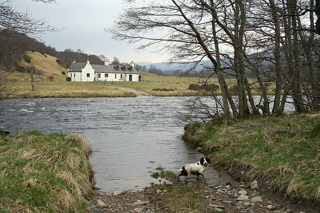
From the map the A'an looks about 50m wide at this point.
From the map the A'an looks about 50m wide at this point.
Better weight than wisdom, a traveller cannot carry
-
fatbikephil
- Posts: 7386
- Joined: Wed Apr 02, 2014 10:51 pm
- Location: Fife
- Contact:
Re: Tiso Overland 500
Was a lot calmer than that the other day (and lower) but that pic says it all really - stuff that for a game of soldiers!
-
adamwwallace
- Posts: 30
- Joined: Thu Jul 28, 2016 12:24 pm
Re: Tiso Overland 500
I like the concept and the effort put in to it, though like Marcus Stitz's Central Belter how many people will do the whole thing? There are a few odd bits around Edinburgh though Deeside looks mostly ok. I think it's been stitched together from actual rides as a look like there are a few wrong turns which made it in to the final version.
-Reversed wrong turn in Dalmeny Estate, SE of the main house. The wrong turn would have actually given more gravel as going that way is the gravelly most of the way round to where it joins the main cycle path at the Miller and Carter pub.
-Completely random detour around Victoria Quay and Ocean Village in Leith
-Leaves the Water of Leith path at Roseburn to go south to the canal, but then leaves the canal to join Lanark Road before going back on to the Water of Leith at Longstone. The WOL of is a bit of a faff around Saughton so fine with skipping that part, but can't see why you'd have to come off the canal to join Lanark Road when you can join the WOL from the bridge over the canal by Redhall Park.
-Detour in to a farmyard SE of Kirknewton airfield
-I can't remember much about the Tarland Way but I don't know why you'd leave and rejoin it for a 1km or so in the middle
-Same for the Deeside Way at Dess
-Realise it's trying to not make it an out and back but it takes North Deeside road one way and the Deeside Way the other when going in an out of Aberdeen. If you're gravelling then just do the Deeside Way both ways?
-Going over Mount Battock is quite a climb but it does get you past Charr bothy at least