

Todays ride
Moderators: Bearbonesnorm, Taylor, Chew
Re: Todays ride
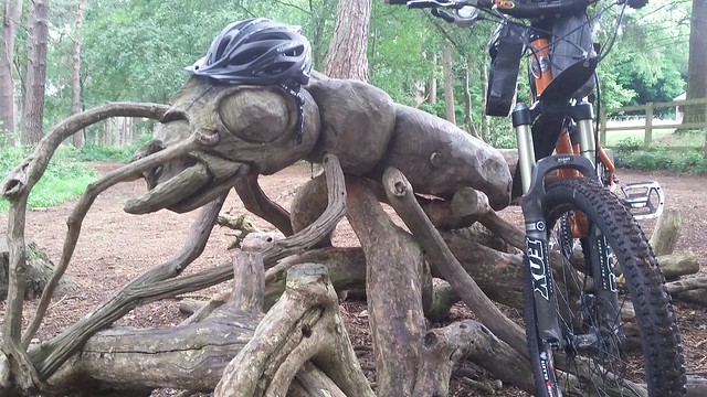
Visited my folks in Dorset for the first time in ages with my brother. Had a lovely retro bike ride to a cafe (Raleigh 501 'gas pipe' Club for me, Peugeot Isoard for my bro). On the way back had the most brilliant coincidence to pass this car at a roundabout, stopped for a chat and photos and my brother now has a new Peugeot geek buddy. Plus, the Peugeot 404 team car plays the opening bar of La Marseillaise on very loud air horn!! 

Re: Todays ride
Tom Simpson has let himself go  Without the photo no one would have believed you, the odds on meeting the team car when in the correct period kit must be nearly zero, that's amazingly good luck
Adventure without risk is Disneyland - Bikemonger
Re: Todays ride
I might have mentioned before my silly reluctance to ride with other people ("proper cyclists")  for fear of struggling with the pace, holding everyone up, etc. etc. blah blah blah (Richard yesterday went as far as calling it imposter syndrome, and said that I'd be surprised how common it is). So I'm well chuffed that (2nd time this year of riding with someone else!) I joined the Brecon tri club ride yesterday - I'd ridden the route a couple of times before which helped, and the invite was so friendly I just couldn't resist ("no drop ride").
 IMG_20210626_195830_528 by Verena Zimmer, on Flickr
We did a loop from Brecon up the Devils Elbow, Ystradfellte, Penderyn, down to the reservoir, Cefn Coed up to Ponsticill and up and over down to Talybont and home.
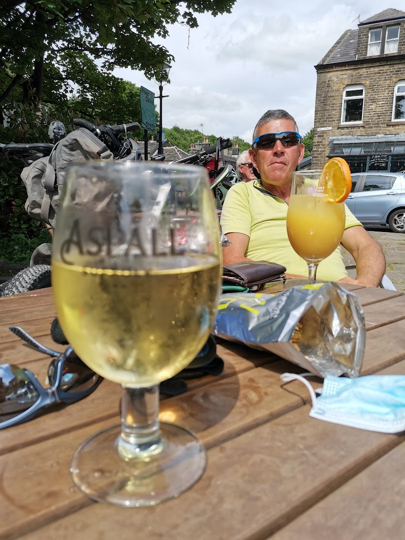
We stopped for a very civilized coffee/ lunch break at The Old Barn tea rooms at Torpantau, bit of a find that, never knew it was there, very nice (one of those places that do teas in all the old fashioned cups and saucers, if you know what I mean)
Worst photo ever, but for any of you passing that way you'd be interested to know that there's an outside tap with drinking water there
 IMG_20210626_130154 by Verena Zimmer, on Flickr
You won't be surprised when I tell you that I had a great time; Rich, Dave, Matt and Tom were great company and were very patient with me, and (shock horror) riding with other people isn't so bad after all
 IMG_20210626_131446 by Verena Zimmer, on Flickr
IMG_20210626_195830_528 by Verena Zimmer, on FlickrWe did a loop from Brecon up the Devils Elbow, Ystradfellte, Penderyn, down to the reservoir, Cefn Coed up to Ponsticill and up and over down to Talybont and home.
We stopped for a very civilized coffee/ lunch break at The Old Barn tea rooms at Torpantau, bit of a find that, never knew it was there, very nice (one of those places that do teas in all the old fashioned cups and saucers, if you know what I mean)
Worst photo ever, but for any of you passing that way you'd be interested to know that there's an outside tap with drinking water there
IMG_20210626_130154 by Verena Zimmer, on FlickrYou won't be surprised when I tell you that I had a great time; Rich, Dave, Matt and Tom were great company and were very patient with me, and (shock horror) riding with other people isn't so bad after all
IMG_20210626_131446 by Verena Zimmer, on Flickr-
RIP

- Posts: 9676
- Joined: Wed Nov 12, 2014 7:24 pm
- Location: Surfing The Shores Of Sanity Since 1959
- Contact:
Re: Todays ride
Look like a friendly bunch they do  . Fantastic circuit that too.
"My God, Ponsonby, I'm two-thirds of the way to the grave and what have I done?" - RIP
"At least you got some stories" - James Acaster
"A little nonsense now and then is relished by the wisest men" - WW
"At least you got some stories" - James Acaster
"A little nonsense now and then is relished by the wisest men" - WW
-
RIP
- Posts: 9676
- Joined: Wed Nov 12, 2014 7:24 pm
- Location: Surfing The Shores Of Sanity Since 1959
- Contact:
Re: Todays ride
Look like a friendly bunch they do . Fantastic circuit that too.
"My God, Ponsonby, I'm two-thirds of the way to the grave and what have I done?" - RIP
"At least you got some stories" - James Acaster
"A little nonsense now and then is relished by the wisest men" - WW
"At least you got some stories" - James Acaster
"A little nonsense now and then is relished by the wisest men" - WW
Re: Todays ride
They were/are, and I was in safe hands: A GP, a pharmacist, an engineer, and two qualified triathlon coaches between them
 , oh and an auditor, I'm sure his skills would've come in handy somehow
-
ScotRoutes
- Posts: 8144
- Joined: Mon Mar 18, 2013 9:56 am
Re: Todays ride
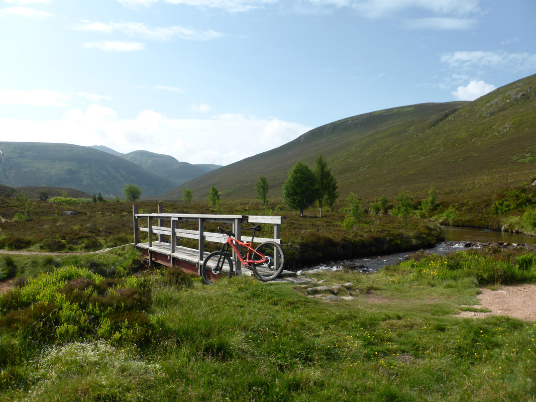
In a similar vein... every year I hesitate to do bigger days out. I think it's that my mileage is cut during the winter and, as spring can drag up here, it takes until half-way through the year that I start to feel confident enough to do the bigger rides. With that in mind I had resolved to repeat a two-day route I'd done previously, but in a single day. It's mostly "gravel" of one form or another so the Amazon was chosen.
I set off just after 9am from Dalwhinnie, already worried that I should have been a lot earlier. It was a cold start but by the time I'd reached Loch Pattack the saun had put in an appearance and my work rate was warming me up. From here I'd normally ride along Lochan na h-Earba but the bridge at the SW end is currently being replaced so I rode alongside Loch Laggan for a change. I've not been this way for a long time so was very pleasantly surprised.
After that, it's the climb to Corrour Station for the only catering stop on the route.

Quite a few other cyclists here as it's on the Badger Divide/ An Turas Mor routes, the former of which seems to have become very, very popular.
Now, I know this makes me a bad person and just shows my poor judgement and prejudices but I was tucking into two lovely Venison Lorne Sausage rolls and washing them down with a pint of beer while 4 riders at the next table were having a serious conversation about the dangers of drinking even a half pint of the weakest beer before riding again and when the waitress brought out two hummus platters for them, I just couldn't help but think #gravelwankers.
Anyway, back to the nice stuff...

Loch Ossian looking as lovely as ever
After this it's the big climb up to the old Lodge for the view out west and then the drop down to Loch Rannoch which was very calm.

Massive number of tents on the lochside along here, doing the wild/dirty camper thing. I can't imagine it's very pleasant as they are almost on top of each other. And yet, I can sort of understand it. There are no campsites close, it's a stunning area, it's the school holidays and travel is restricted. I could almost ignore/forgive it all if not for the pall of woodsmoke over the area.
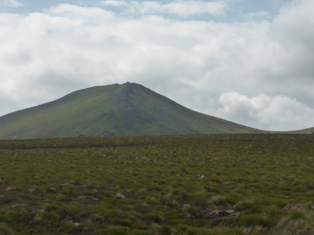
After a while on tarmac, it's the big climb of the day, up to Duinish bothy.

For those not in the know, that pointy hill in the background is Schiehallion (the fairy hill of the Caledons) and is where contour lines were "invented" as Sir Nevile Maskelyne set out to estimate the density of the Earth.
The one boggy bit of the day is at the head of Loch Garry but it's only about 1.5km and, even though some of that is ridable, I was looking forward to getting back onto the lochside track. However, it's been "repaired" with some massive boulders and was a really rough journey. The billiard-table tarmac of NCN7 running alongside the A9 was therefore very welcome
124km in 7h20m moving time. Not too bad given my expectations. However, I need a plan for next winter, keeping up with some long rides regardless of the weather and (more importantly) ground/road conditions. Maybe I should emigrate south for a few months!
I set off just after 9am from Dalwhinnie, already worried that I should have been a lot earlier. It was a cold start but by the time I'd reached Loch Pattack the saun had put in an appearance and my work rate was warming me up. From here I'd normally ride along Lochan na h-Earba but the bridge at the SW end is currently being replaced so I rode alongside Loch Laggan for a change. I've not been this way for a long time so was very pleasantly surprised.
After that, it's the climb to Corrour Station for the only catering stop on the route.
Quite a few other cyclists here as it's on the Badger Divide/ An Turas Mor routes, the former of which seems to have become very, very popular.
Now, I know this makes me a bad person and just shows my poor judgement and prejudices but I was tucking into two lovely Venison Lorne Sausage rolls and washing them down with a pint of beer while 4 riders at the next table were having a serious conversation about the dangers of drinking even a half pint of the weakest beer before riding again and when the waitress brought out two hummus platters for them, I just couldn't help but think #gravelwankers.
Anyway, back to the nice stuff...
Loch Ossian looking as lovely as ever
After this it's the big climb up to the old Lodge for the view out west and then the drop down to Loch Rannoch which was very calm.
Massive number of tents on the lochside along here, doing the wild/dirty camper thing. I can't imagine it's very pleasant as they are almost on top of each other. And yet, I can sort of understand it. There are no campsites close, it's a stunning area, it's the school holidays and travel is restricted. I could almost ignore/forgive it all if not for the pall of woodsmoke over the area.
After a while on tarmac, it's the big climb of the day, up to Duinish bothy.
For those not in the know, that pointy hill in the background is Schiehallion (the fairy hill of the Caledons) and is where contour lines were "invented" as Sir Nevile Maskelyne set out to estimate the density of the Earth.
The one boggy bit of the day is at the head of Loch Garry but it's only about 1.5km and, even though some of that is ridable, I was looking forward to getting back onto the lochside track. However, it's been "repaired" with some massive boulders and was a really rough journey. The billiard-table tarmac of NCN7 running alongside the A9 was therefore very welcome
124km in 7h20m moving time. Not too bad given my expectations. However, I need a plan for next winter, keeping up with some long rides regardless of the weather and (more importantly) ground/road conditions. Maybe I should emigrate south for a few months!
-
RIP
- Posts: 9676
- Joined: Wed Nov 12, 2014 7:24 pm
- Location: Surfing The Shores Of Sanity Since 1959
- Contact:
Re: Todays ride
with an avocado garnish?
nice snippetSchiehallion (the fairy hill of the Caledons) and is where contour lines were "invented" as Sir Nevile Maskelyne set out to estimate the density of the Earth.
"My God, Ponsonby, I'm two-thirds of the way to the grave and what have I done?" - RIP
"At least you got some stories" - James Acaster
"A little nonsense now and then is relished by the wisest men" - WW
"At least you got some stories" - James Acaster
"A little nonsense now and then is relished by the wisest men" - WW
-
ledburner

- Posts: 2040
- Joined: Mon Oct 12, 2020 8:47 am
- Location: The worsted place in West Yorkshire,
Re: Todays ride (updated typos n'all)
[well actually yesterday] A ride around some of the ground covered in Shafs Dark peak 100, just sticking to Kirklees. about 25 miles. we visited most of the good spots between Almondbury & Marden, but not necessarily in shafs order.
*Bonus* we found new farm tracks & it was hot so we came down Wesseden. the best way on a hot day. mostly incident free*
A non tea total refreshment and gyration at the River Head Tap, by the river, with entertainment provided by a gammon **,
involving the waitress and [then the] manager who handled it impeccably, took their drink & not serving you or risking my licence. A pootle 5 mile down Huddersfield Narrow Canal perfect finish.
*as a quick tyre change this morning I fitted a tube as it was a bugger to seat before. on the same rocky steps of doom, that took out Shaff wonder [edit:] Sonder. (I got a snake bite puncture 45psi at start of ride more than enough for a 29er 2.0" tyre and midway for their recommendations.)
lesson learned don't take the smallest mini pum or consider CO2 cartridges.. .

Proof I was a the top of Wesseden.(as chief photographer).. check out those vintage shoes...
appropriate hydration regime a shandy drinker, . Dry cyder shandy refreshing, still a shandy drinker, I know...
** white haired gammon, in shades, in background.
*Bonus* we found new farm tracks & it was hot so we came down Wesseden. the best way on a hot day. mostly incident free*
A non tea total refreshment and gyration at the River Head Tap, by the river, with entertainment provided by a gammon **,
involving the waitress and [then the] manager who handled it impeccably, took their drink & not serving you or risking my licence. A pootle 5 mile down Huddersfield Narrow Canal perfect finish.
*as a quick tyre change this morning I fitted a tube as it was a bugger to seat before. on the same rocky steps of doom, that took out Shaff wonder [edit:] Sonder. (I got a snake bite puncture 45psi at start of ride more than enough for a 29er 2.0" tyre and midway for their recommendations.)
lesson learned don't take the smallest mini pum or consider CO2 cartridges.. .
Proof I was a the top of Wesseden.(as chief photographer).. check out those vintage shoes...
appropriate hydration regime a shandy drinker, . Dry cyder shandy refreshing, still a shandy drinker, I know...
** white haired gammon, in shades, in background.
I hope you think you know, what I might of exactly meant.
Warning - may contain value odded typos & ither mythspellings..
Warning - may contain value odded typos & ither mythspellings..
Re: Todays ride
Quite a few fields full of borage, and other full of what looks a bit like pea flowers or some such; very cheery to cycle passed...
There are theories at the bottom of my jargon.
Re: Todays ride
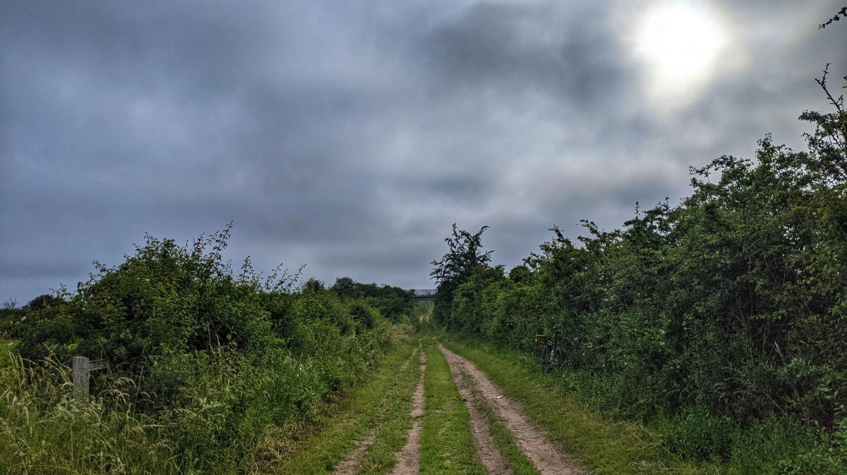
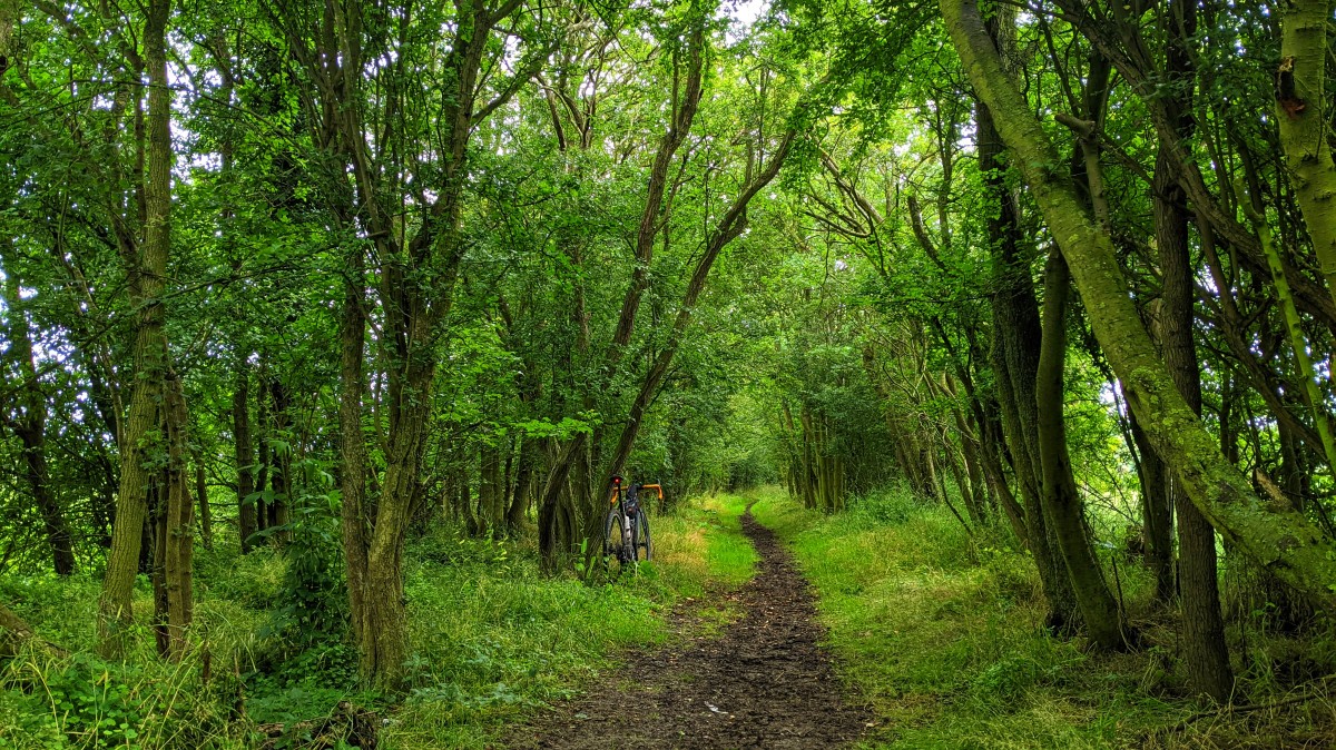
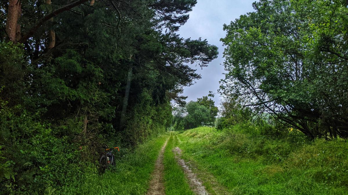
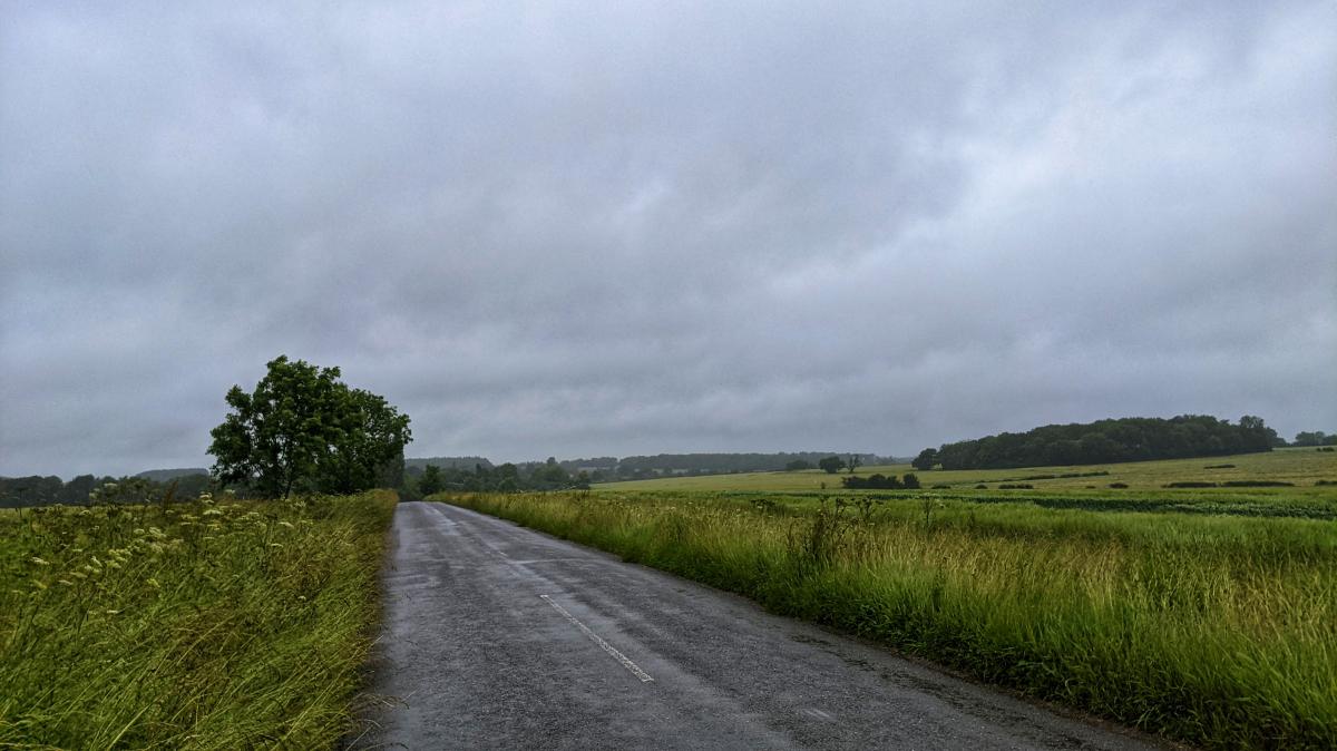
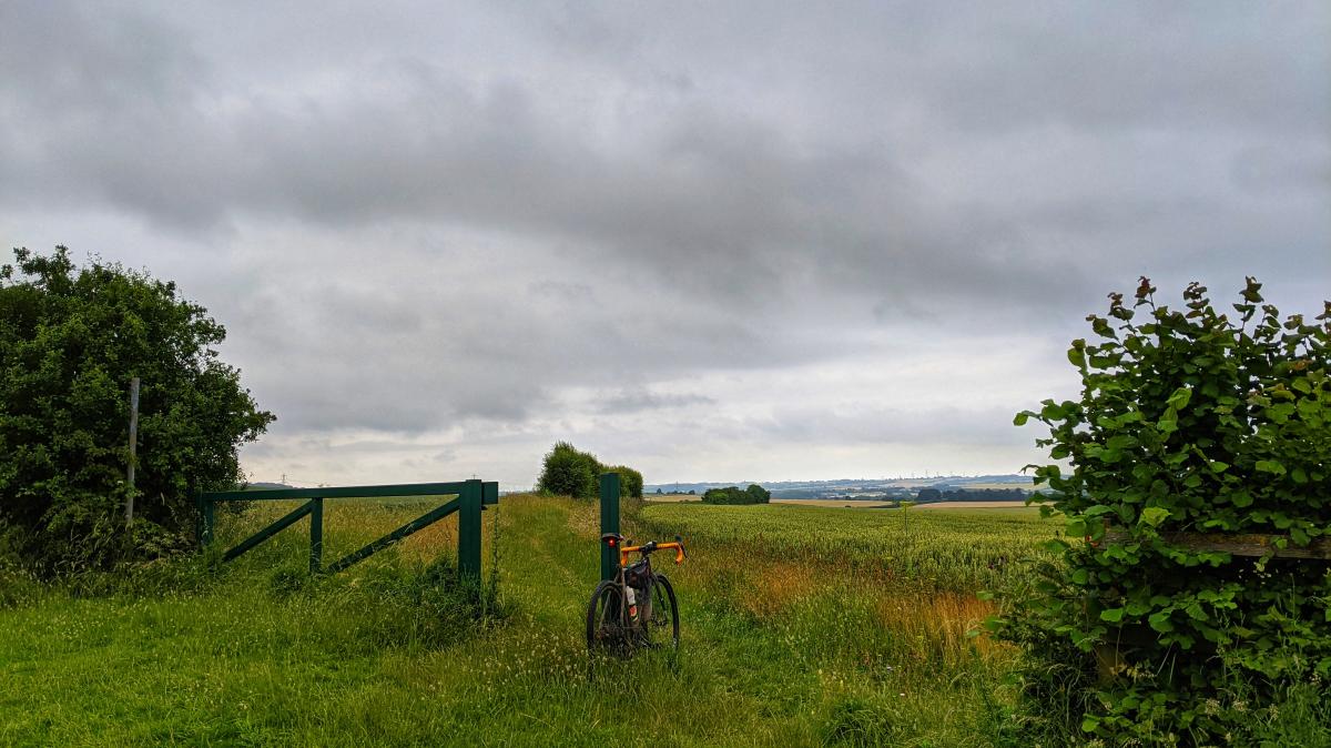
Headed out this morning to get a few kilometres in the legs before the forecasted early afternoon rain. Left late enough to miss the early morning dog walkers, which meant I didn't see another soul for the first hour or so; which was nice.
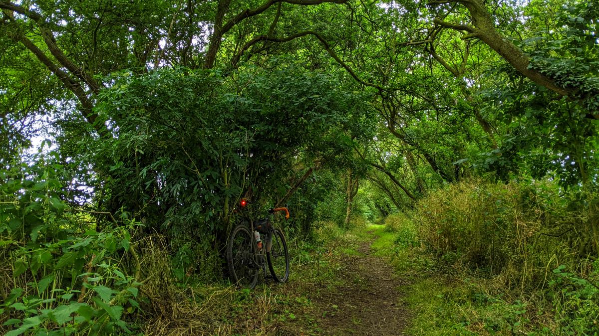
I couldn't decided which way to go, and ended up deciding as I rolled down the driveway. I should've checked the weather forecast for that direction though, as it started pelting it down after a couple of hours. I was soaked, the vegetation was soaked and the worst of all, the surface layer of the byways and bridleways was soaked I also took a wrong turn and ended up on the one byway I was trying to avoid; you could easily go swimming in some of the bomb holes.
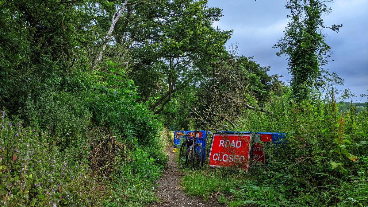
Interestingly, they have blocked off both ends to any sort of vehicle and there are signs up saying they're going to do repair work. Not before time... Thankfully the rain eventually stopped, and the surface water started to be absorbed, so the surfaces went from being slidey, to being grippy. As I came bouncing down this horse hoof chewed up monstrosity of a bridleway, a red kite burst out of a tree and started flying in front of me, which was pretty cool.
By this point I was covered in crap, so in for a penny, in for a pound, and I headed for a coupe of byways and bridleways that I knew would be in pretty poor show condition. I wasn't disappointed, with tyre pick up so bad, that I ground to a halt on a number of occasions, and had to prise all the mud off with a stick.
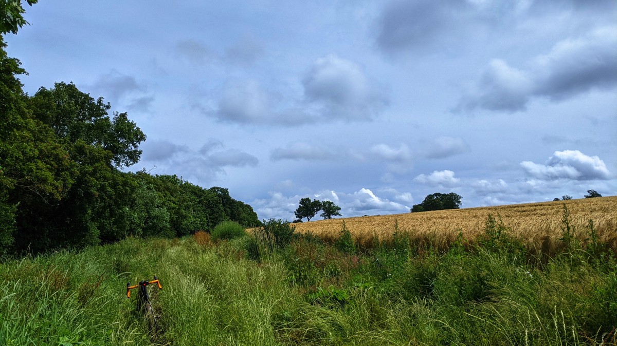
I suppose I should spend the next few months riding all the local poor show that I normally avoid, in preparation for the BB200...
I couldn't decided which way to go, and ended up deciding as I rolled down the driveway. I should've checked the weather forecast for that direction though, as it started pelting it down after a couple of hours. I was soaked, the vegetation was soaked and the worst of all, the surface layer of the byways and bridleways was soaked I also took a wrong turn and ended up on the one byway I was trying to avoid; you could easily go swimming in some of the bomb holes.
Interestingly, they have blocked off both ends to any sort of vehicle and there are signs up saying they're going to do repair work. Not before time... Thankfully the rain eventually stopped, and the surface water started to be absorbed, so the surfaces went from being slidey, to being grippy. As I came bouncing down this horse hoof chewed up monstrosity of a bridleway, a red kite burst out of a tree and started flying in front of me, which was pretty cool.
By this point I was covered in crap, so in for a penny, in for a pound, and I headed for a coupe of byways and bridleways that I knew would be in pretty poor show condition. I wasn't disappointed, with tyre pick up so bad, that I ground to a halt on a number of occasions, and had to prise all the mud off with a stick.
I suppose I should spend the next few months riding all the local poor show that I normally avoid, in preparation for the BB200...
There are theories at the bottom of my jargon.
Re: Todays ride
Every day's a school day, it's just sometimes you need refresher lessons...
The weather forecast wasn't great, I knew I was going to get wet, it was just a matter of when. It's July, I got wet on Sunday and was fine, so I didn't bother to take my packable waterproof, what a mistake. It came in waves, and I was fine for the first one, utterly soaked though, but still comfortable. The wind soon put pay to that though and after the second deluge, my hands started to stiffen up.
After the third deluge, I couldn't feel my hands, forearms, thighs or feet; I couldn't get my heart rate up and any warmth I was generating was instantly stripped away by the wind and rain. I was a puncture or mechanical away from being in deep, deep doodoo.
I could barely use the zip on the frame bag to get my keys out and get in the door. Shoes and socks dispensed with, it was straight into the shower, still in the mucky cycle clothing, to warm up. Stupid, stupid, stupid.
I would probably have been fine if I'd had arm warmers, a gillet, or my neoprene gloves on. Muppet.
There are theories at the bottom of my jargon.
-
ledburner
- Posts: 2040
- Joined: Mon Oct 12, 2020 8:47 am
- Location: The worsted place in West Yorkshire,
Re: Todays ride
were glad you're OK.K1100T wrote: ↑Tue Jul 06, 2021 11:27 am Every day's a school day, it's just sometimes you need refresher lessons...
The weather forecast wasn't great, I knew I was going to get wet, it was just a matter of when. It's July, I got wet on Sunday and was fine, so I didn't bother to take my packable waterproof, what a mistake....
After the third deluge, I couldn't feel my hands, forearms, thighs or feet; I couldn't get my heart rate up and any warmth I was generating was instantly stripped away by the wind and rain. I was a puncture or mechanical away from being in deep, deep doodoo....
I would probably have been fine if I'd had arm warmers, a gillet, or my neoprene gloves on. Muppet.
I've been caught out, I try and find shelter, I never was any good at warm up on the bike.
it doesn't sound like that was an option for you..
tough lessons...
I hope you think you know, what I might of exactly meant.
Warning - may contain value odded typos & ither mythspellings..
Warning - may contain value odded typos & ither mythspellings..
Re: Todays ride
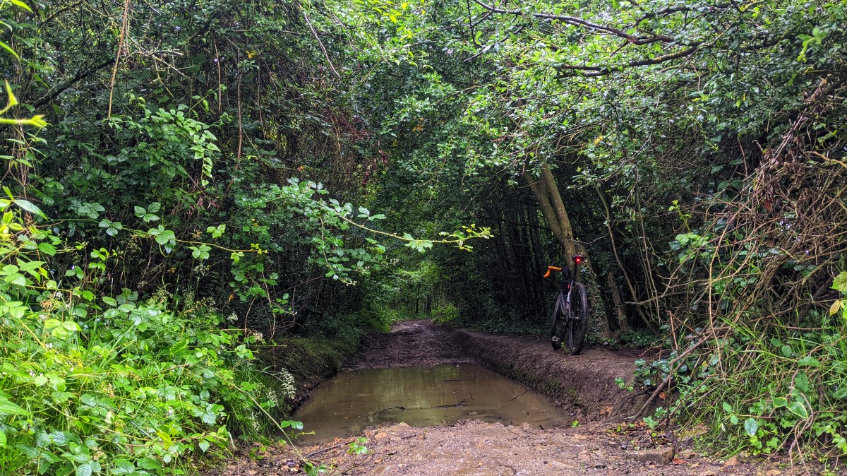
Came to visit my parents in north Devon for the week (when you can work from home it doesn't matter whose home!) and got the train down on Saturday. To save them having to come and pick me up it seemed the obvious choice to ride over from Barnstaple to Ilfracombe.
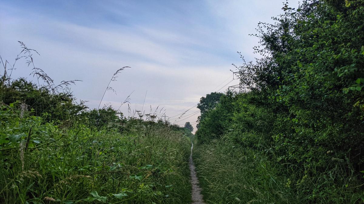
I'd done the Tarka Trail route before so opted for a more direct route which was mostly quite nice. This bridleway followed a stream bed for a hundred yards or so, and then further up the hill had a series of little concrete steps, all but the biggest (unrideable) one of which I managed to ride up

A bit of refreshing drizzle at the top with a nice view across to the coast and some flowers and stuff. And windmills.


Then yesterday morning the sun was shining (though not for long) so I went out to find some more hills before starting work. This is the old road over to Lee which is one of the few bits of coast path you can legally ride on. The steep bit you can see disappearing round the corner has ridges carved out of the rock to help the horses and carts grip. Still pretty slippery in the wet but all rideable.

Weather started closing in a bit

As did the vicious bull wannabes.

Having evaded the cattle there was a nice tarmac descent to Lee down a very narrow lane (a kind builder reversed his van back down the hill a bit to a wider gateway to let me squeeze through so I didn't have to backtrack up the hill). Then just time for a quick stop on the beach before the climb back out, which from sea level to 201 metres in one hit with a "double chevron" on the map at the bottom is plenty hilly enough for a Hampshire native. And back to my desk for five past nine :)

I'd done the Tarka Trail route before so opted for a more direct route which was mostly quite nice. This bridleway followed a stream bed for a hundred yards or so, and then further up the hill had a series of little concrete steps, all but the biggest (unrideable) one of which I managed to ride up
A bit of refreshing drizzle at the top with a nice view across to the coast and some flowers and stuff. And windmills.
Then yesterday morning the sun was shining (though not for long) so I went out to find some more hills before starting work. This is the old road over to Lee which is one of the few bits of coast path you can legally ride on. The steep bit you can see disappearing round the corner has ridges carved out of the rock to help the horses and carts grip. Still pretty slippery in the wet but all rideable.
Weather started closing in a bit
As did the vicious bull wannabes.
Having evaded the cattle there was a nice tarmac descent to Lee down a very narrow lane (a kind builder reversed his van back down the hill a bit to a wider gateway to let me squeeze through so I didn't have to backtrack up the hill). Then just time for a quick stop on the beach before the climb back out, which from sea level to 201 metres in one hit with a "double chevron" on the map at the bottom is plenty hilly enough for a Hampshire native. And back to my desk for five past nine :)
Re: Todays ride
You're not a proper cyclist until you've had to do that
Adventure without risk is Disneyland - Bikemonger
-
RIP
- Posts: 9676
- Joined: Wed Nov 12, 2014 7:24 pm
- Location: Surfing The Shores Of Sanity Since 1959
- Contact:
Re: Todays ride
I always extract huge pleasure from riding up/down stream-bound RoW. That looked a nice one. In the same vein as https://www.wetroads.co.uk/ I think we need a wetbridleways.co.uk site
One of my faves near me:

"My God, Ponsonby, I'm two-thirds of the way to the grave and what have I done?" - RIP
"At least you got some stories" - James Acaster
"A little nonsense now and then is relished by the wisest men" - WW
"At least you got some stories" - James Acaster
"A little nonsense now and then is relished by the wisest men" - WW
Re: Todays ride
Good, aren't they. The Devon one above is at SS539384. It says "Ford" on the 1:25000 OS map.RIP wrote: ↑Tue Jul 06, 2021 3:43 pmI always extract huge pleasure from riding up/down stream-bound RoW. That looked a nice one. In the same vein as https://www.wetroads.co.uk/ I think we need a wetbridleways.co.uk site
From perusing wetroads.co.uk a few years ago I harboured an ambition to ride the East Worldham track mentioned on the Hampshire page. I finally got round to it last year and it's great fun, even if it was totally dry along most of its length when I did it. I think the line between boringly dry and impassably wet would probably be quite fine as it is about a mile long, of which more than half is stream bed.

-
RIP
- Posts: 9676
- Joined: Wed Nov 12, 2014 7:24 pm
- Location: Surfing The Shores Of Sanity Since 1959
- Contact:
Re: Todays ride
That's a corker isn't it . Yep, really enjoy fords too.
One of the BBB winter events some years ago was called Ford Fiesta. Disappointed I missed it. Although some of the photos showed participants having rather an, er, 'exciting' time of it .
One of the BBB winter events some years ago was called Ford Fiesta. Disappointed I missed it. Although some of the photos showed participants having rather an, er, 'exciting' time of it
"My God, Ponsonby, I'm two-thirds of the way to the grave and what have I done?" - RIP
"At least you got some stories" - James Acaster
"A little nonsense now and then is relished by the wisest men" - WW
"At least you got some stories" - James Acaster
"A little nonsense now and then is relished by the wisest men" - WW
-
RIP
- Posts: 9676
- Joined: Wed Nov 12, 2014 7:24 pm
- Location: Surfing The Shores Of Sanity Since 1959
- Contact:
Re: Todays ride
and why not indeed...
"My God, Ponsonby, I'm two-thirds of the way to the grave and what have I done?" - RIP
"At least you got some stories" - James Acaster
"A little nonsense now and then is relished by the wisest men" - WW
"At least you got some stories" - James Acaster
"A little nonsense now and then is relished by the wisest men" - WW
Re: Todays ride
Did a quick loop from home last night. Just over 20 miles but sadly all on the road, quite a lot of rain here so didn't fancy getting covered in filth and only had about 90 min spare.
But the nice bit was that I got passed by around 10 cars in those 20 miles, was so quiet. And most of those passes was on a busier road on the way back. Miles of no cars, lovely. Weather was mild too, mid teens with no rain. Almost had a full frontal facial impact with a bat, no idea how it didn't hit me! Must have been a couple of centimetres away from a collision, I braced and everything
But the nice bit was that I got passed by around 10 cars in those 20 miles, was so quiet. And most of those passes was on a busier road on the way back. Miles of no cars, lovely. Weather was mild too, mid teens with no rain. Almost had a full frontal facial impact with a bat, no idea how it didn't hit me! Must have been a couple of centimetres away from a collision, I braced and everything
-
ScotRoutes
- Posts: 8144
- Joined: Mon Mar 18, 2013 9:56 am
Re: Todays ride
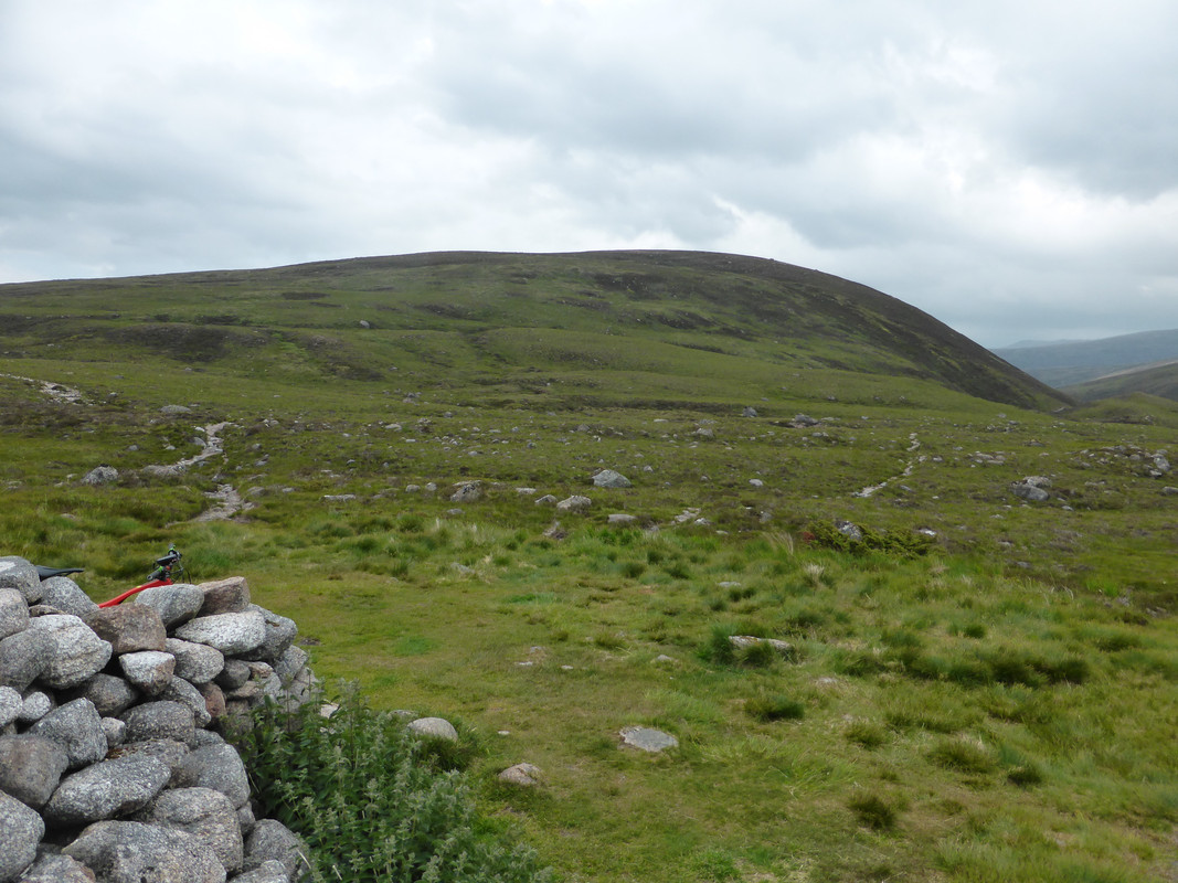
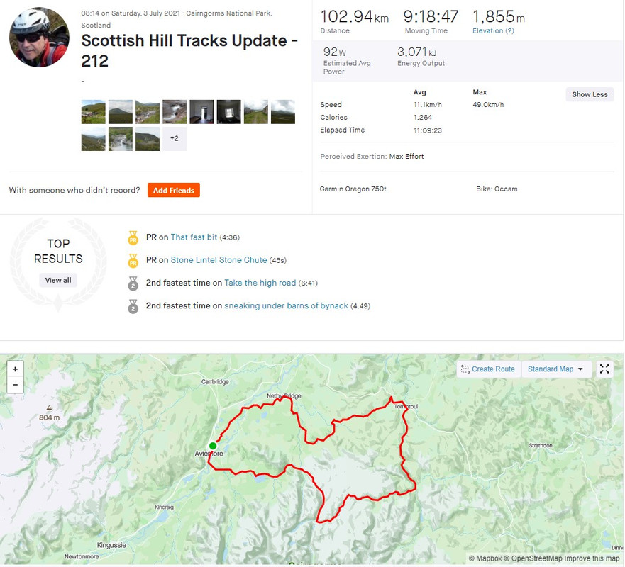
A wee bit late in posting this but might be handy if folk are searching for Cairngorms routes.
The Scottish Rights of Way Society publish a book - Scottish Hill Tracks - and it is due an update. I'm one of the folk re-surveying and updating the route descriptions. I took on a few around the Cairngorms and one section I've never been on is that bit between Fords of Avon and Inchrory. I looked at various ways of getting to/along it and eventually decided I'd do a loop from home via Glenmore, Bynack Mor, Fords of Avon, Tomintoul and back home. I knew of the hike-a-bike section around Bynack Mor and expected more torwards Faindouran.
The weather forecast wasn't great so I was carrying a decent amount of kit. That wasn't best for the climb up Bynack Mor but better than arriving at it with full bikepacking kit and having ridden from Blair Atholl. This is crossing the River Nethy at the foot of the big climb up Bynack Mor.
Folk familiar with the Cairngorms Loop route will be familiar with this view. Bynack Mor.
Ben Avon away in the distance. I'd traverse below this later. It looks nearer than it is

I overtook some walkers and a couple of other cyclists on the descent to Fords of Avon, though I was taking it fairly easy on the descent as it's not a place to have an off, especially if riding solo. I reached the shelter just before midday, so not exactly record pace. This would be me now on unfamiliar ground.
Looking East along the path to Faindouran.
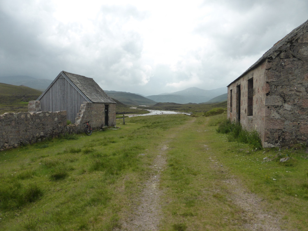
As expected there was a fair amount of footwork heading along the river. I was cursing my decision to wear the Shimano "flatties" rather than my walking boots as I had a couple of slips, though nothing that had me on my arse. I'd seen an estimate that the track was "about 60% rideable". That's probably about right, though that was often 6m in every 10m so not worth jumping on and off the bike. The route is clear enough until it heads away from the river, where it gets a bit boggy. However a (very) old line of cairns can be followed. About 1km from Faindouran a rough landrover track is reached and this improves hugely at Faindouran itself. There is a MBA bothy here - in very good condition.
Having left a busy Aviemore/Glenmore and then seeing folk going up and down Bynack Mor, this section just seemed so desolate, lonely and remote. Some very moody clouds threatened rain but came to nothing.

Thoughts that it would be easy from here to Inchrory disappeared when I encountered some of the hills on the route.
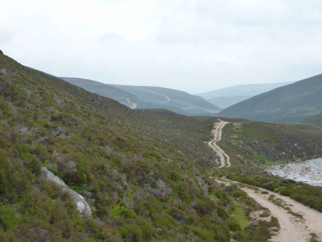
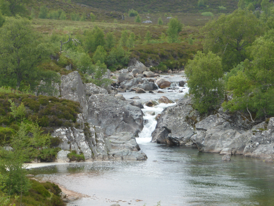
Just before Inchrory, I came across the Linn of Avon. If I'd thought I'd had more time I'd have definitely had a swim here but I was already pretty knackered and knew I wasn't half way round yet.
I arrived in Tomintoul very hungry so high-tailed it to the Glenavon for a bit of lunch (it was already after 3pm). I was very tempted by the thought of a big hamburger and chips but experience tells me that I struggle to eat that amount while in this condition so satisfied myself with soup and a sandwich (plus a beer for rehydration).
As I was heading out of Tomintoul I encountered three horses and riders. Turned it they were part of a larger group heading towards Nethy Bridge. We chatted at one of the gates then played a bit of passing and re-passing as they were quicker uphill and I was quicker on the descents. The biggest problem they gave me was that I kept inheriting all the flies
I do like seeing horses out on these old RoWs and was very impressed at how capable they were on some of the very difficult terrain, and jealous of their dry-shod river crossings. I'd long since taken to just wading rather than faffing about trying to keep dry feet.

Garmin says 103km and 1,855m of ascent. It didn't record how much of that was walking
The Scottish Rights of Way Society publish a book - Scottish Hill Tracks - and it is due an update. I'm one of the folk re-surveying and updating the route descriptions. I took on a few around the Cairngorms and one section I've never been on is that bit between Fords of Avon and Inchrory. I looked at various ways of getting to/along it and eventually decided I'd do a loop from home via Glenmore, Bynack Mor, Fords of Avon, Tomintoul and back home. I knew of the hike-a-bike section around Bynack Mor and expected more torwards Faindouran.
The weather forecast wasn't great so I was carrying a decent amount of kit. That wasn't best for the climb up Bynack Mor but better than arriving at it with full bikepacking kit and having ridden from Blair Atholl. This is crossing the River Nethy at the foot of the big climb up Bynack Mor.
Folk familiar with the Cairngorms Loop route will be familiar with this view. Bynack Mor.
Ben Avon away in the distance. I'd traverse below this later. It looks nearer than it is
I overtook some walkers and a couple of other cyclists on the descent to Fords of Avon, though I was taking it fairly easy on the descent as it's not a place to have an off, especially if riding solo. I reached the shelter just before midday, so not exactly record pace. This would be me now on unfamiliar ground.
Looking East along the path to Faindouran.
As expected there was a fair amount of footwork heading along the river. I was cursing my decision to wear the Shimano "flatties" rather than my walking boots as I had a couple of slips, though nothing that had me on my arse. I'd seen an estimate that the track was "about 60% rideable". That's probably about right, though that was often 6m in every 10m so not worth jumping on and off the bike. The route is clear enough until it heads away from the river, where it gets a bit boggy. However a (very) old line of cairns can be followed. About 1km from Faindouran a rough landrover track is reached and this improves hugely at Faindouran itself. There is a MBA bothy here - in very good condition.
Having left a busy Aviemore/Glenmore and then seeing folk going up and down Bynack Mor, this section just seemed so desolate, lonely and remote. Some very moody clouds threatened rain but came to nothing.
Thoughts that it would be easy from here to Inchrory disappeared when I encountered some of the hills on the route.
Just before Inchrory, I came across the Linn of Avon. If I'd thought I'd had more time I'd have definitely had a swim here but I was already pretty knackered and knew I wasn't half way round yet.
I arrived in Tomintoul very hungry so high-tailed it to the Glenavon for a bit of lunch (it was already after 3pm). I was very tempted by the thought of a big hamburger and chips but experience tells me that I struggle to eat that amount while in this condition so satisfied myself with soup and a sandwich (plus a beer for rehydration).
As I was heading out of Tomintoul I encountered three horses and riders. Turned it they were part of a larger group heading towards Nethy Bridge. We chatted at one of the gates then played a bit of passing and re-passing as they were quicker uphill and I was quicker on the descents. The biggest problem they gave me was that I kept inheriting all the flies
I do like seeing horses out on these old RoWs and was very impressed at how capable they were on some of the very difficult terrain, and jealous of their dry-shod river crossings. I'd long since taken to just wading rather than faffing about trying to keep dry feet.
Garmin says 103km and 1,855m of ascent. It didn't record how much of that was walking

Re: Todays ride
Brilliant Colin.
Re: Todays ride
Tough job that Scotroutes! Good work!
-
ScotRoutes
- Posts: 8144
- Joined: Mon Mar 18, 2013 9:56 am


Re: Todays ride
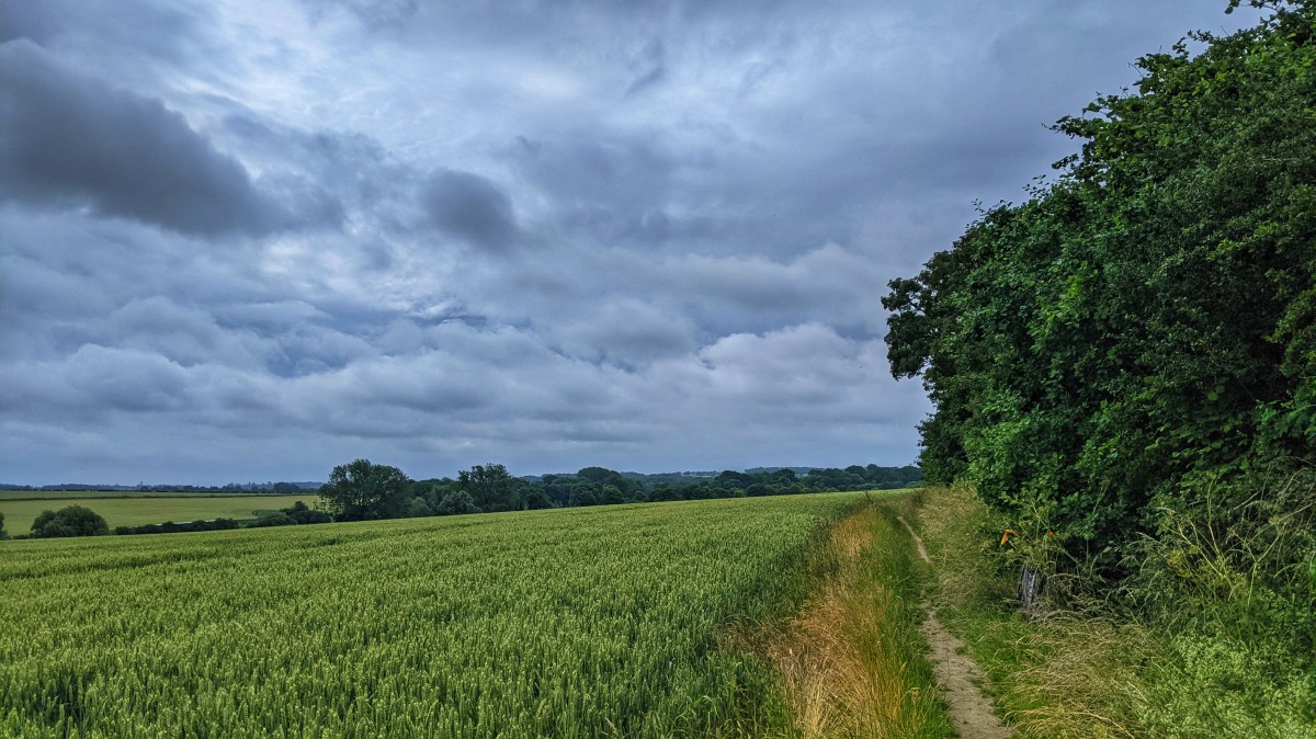
Nice to be out this morning, and remain dry for a change...
Some of the byways and bridleways had even been mowed, or had their edges strimmed...
Still, we managed to arrive home bleeding from both arms and stung to buggery.
Some of the byways and bridleways had even been mowed, or had their edges strimmed...
Still, we managed to arrive home bleeding from both arms and stung to buggery.
There are theories at the bottom of my jargon.