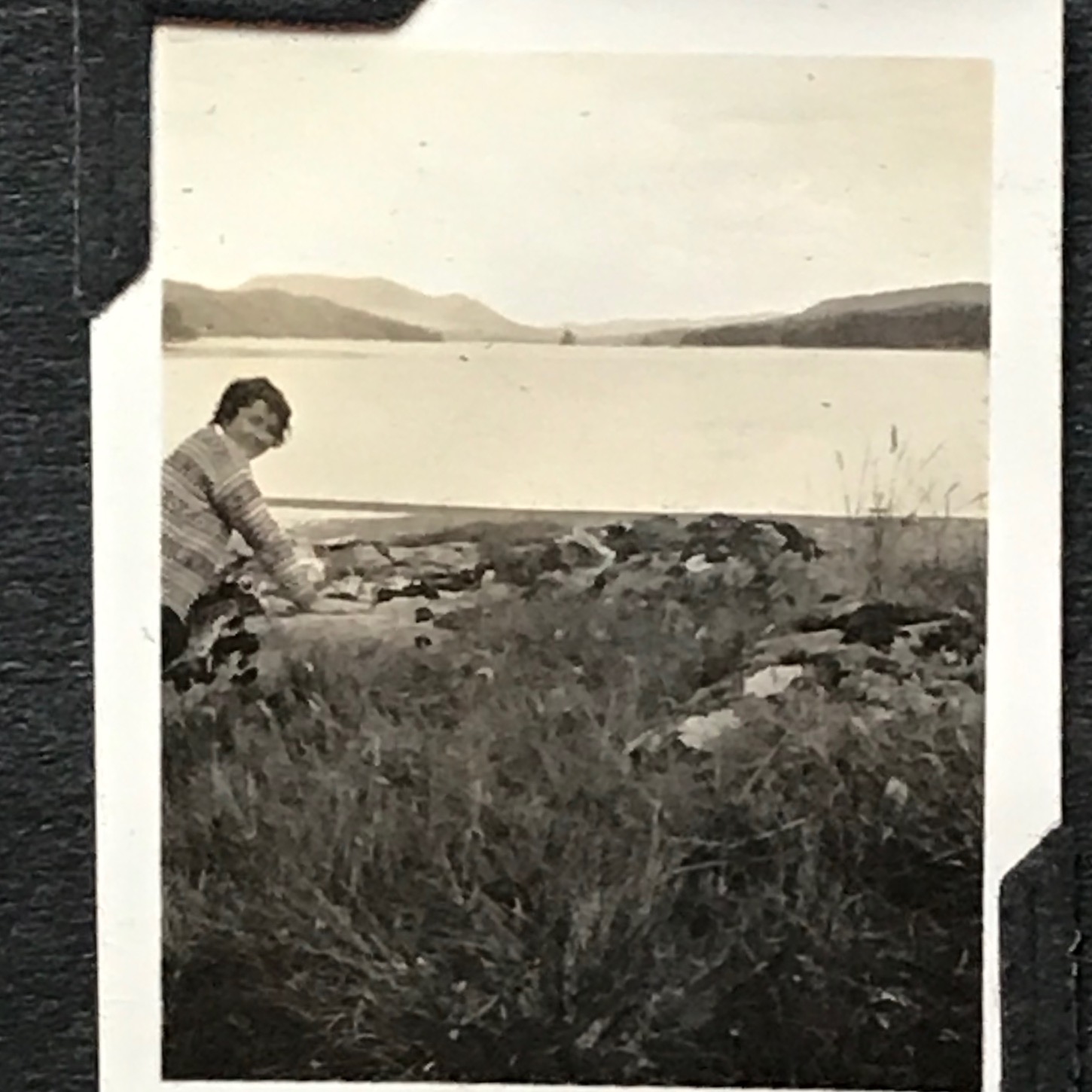
A female cyclist in the US posted (in a Facebook group) a picture of her late mum bike touring 'somewhere' in Scotland from 1938.
We had 2 images to go off...
the map of the route, remember this is 1938
 93574204_890721061366817_5182904926354800640_n by Jeff Price, on Flickr
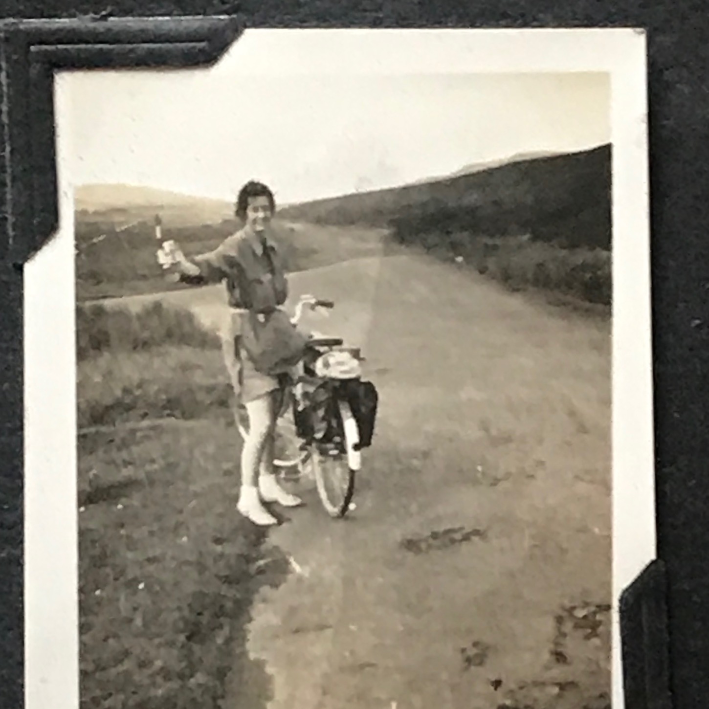
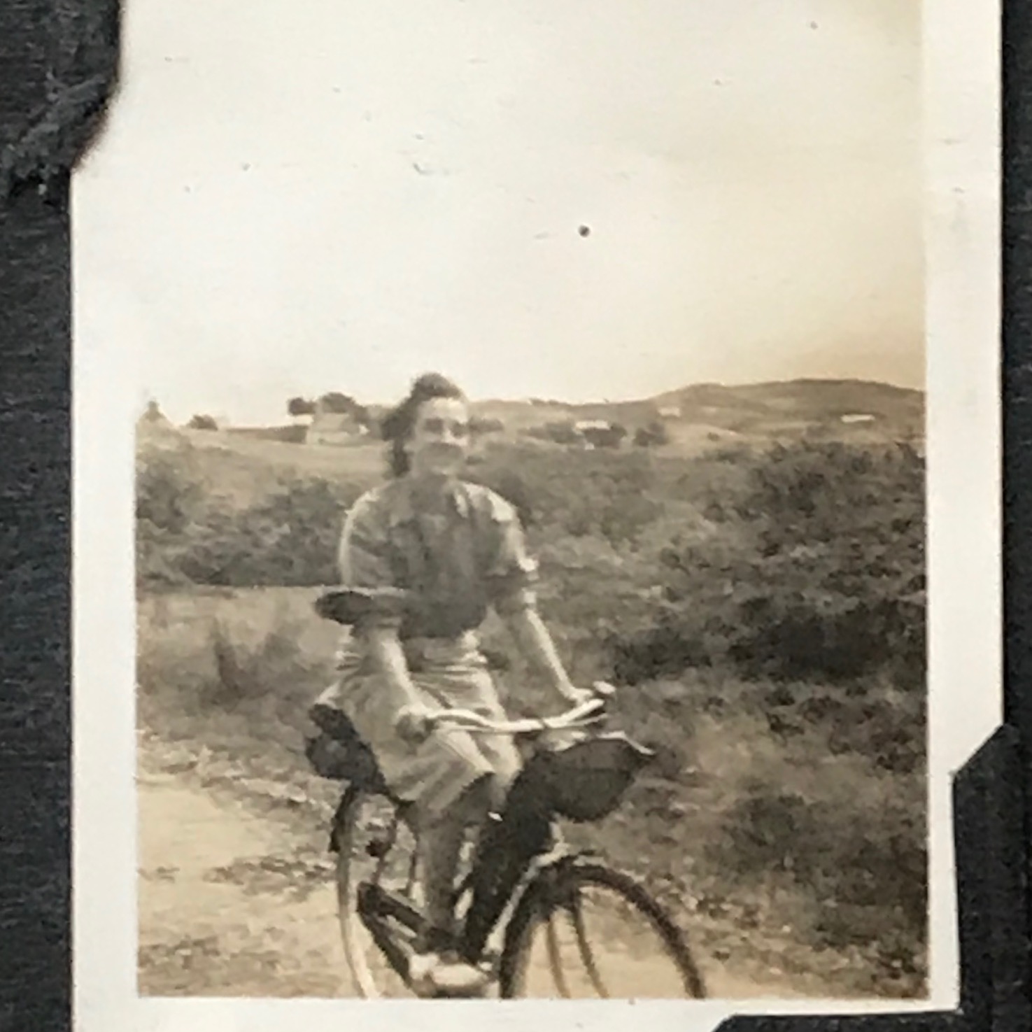
And her mum with her bike somewhere on the monster route
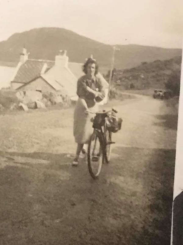 94075777_890721034700153_5375492672951681024_n by Jeff Price, on Flickr
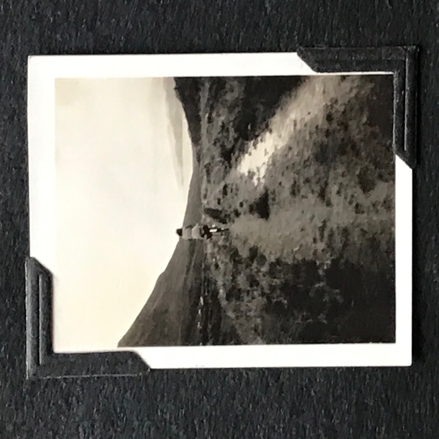
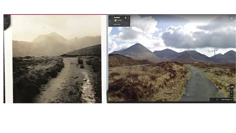
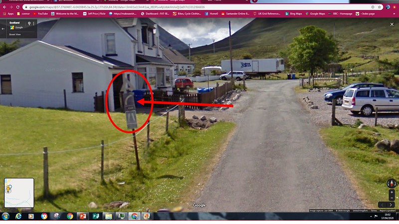
So as I'm like most of you who love looking at maps and Google streetview I thought I'd take up the challenge.
I observed the shadow, which meant the image was facing east. I noticed the loch to the left of the pic behind the house. The shape of the hill in the background. The road, the bend near the bottom of the hill.
Surely it couldn't be found....
and then...
Boom! on Skye!
 Scotland pic by Jeff Price, on Flickr
To say I was made up was an understatement, let alone how the daughter of the lady in the picture feels.
Also messaged a mate who is a copper on Skye later on and he told me its just been demolished to make way for a new build!
However just 2 miles north is an original road sign from that era!
 sign by Jeff Price, on Flickr
So being a bit of a geek with maps/locations/imagery works well
Cheers!