
No idea, I didn't ask and they didn't say. I was in a bit if a daze tbh, having spent the preceding 18 hours on the bike. Did seen odd though, going for a walk at 3am. About as odd as turning up at 1am from a bike rideflatfishy wrote:Any idea why they left?
Did they think you were the Nant Rhys strangler or something?
Bivvy a month for 2013
Moderators: Bearbonesnorm, Taylor, Chew
Re: Bivvy a month for 2013

Re: Bivvy a month for 2013
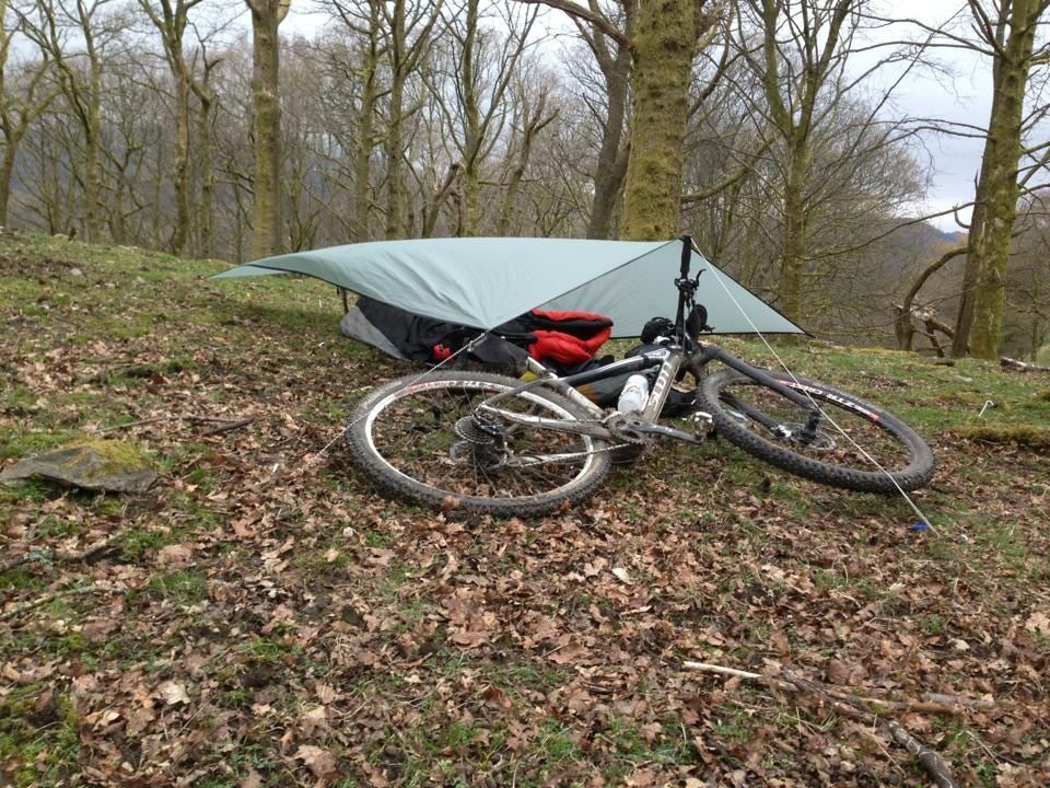
4/4 April done (20th weekend) and it was a right old mixture.
Arrived in the lakes fairly late (10pm) and went to the pub, followed by a bivi behind the park.
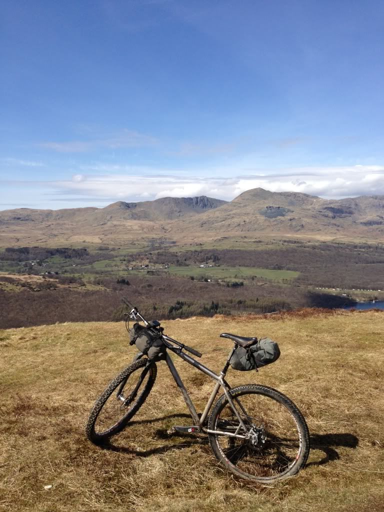
good ride in stunning weather on saturday out over loughrigg, latterbarrow, parkamoor, stephenson ground, seathwaite, walna scar.
A pint and great food in coniston and popped back up into grizedale for a bivi.
Sunday was a washout and lashing down all day. With a brief ride through grizedale then over Iron Keld, Oxen Fell and through elterwater to loughrigg to finish the day was done.
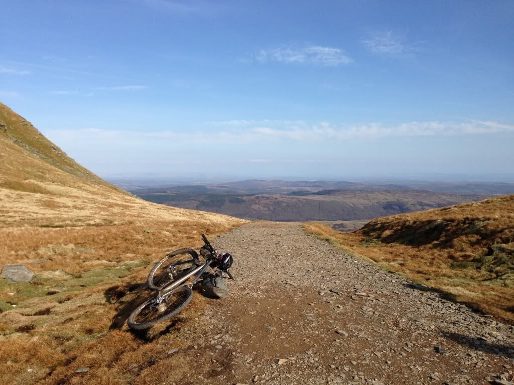
Parkamoor ripped another lightweight tyre (rode the rest of the route with a boot in) and the descent into seathwaite ended my experiment with rigid forks which will be reserved for smoother trips now.
Arrived in the lakes fairly late (10pm) and went to the pub, followed by a bivi behind the park.
good ride in stunning weather on saturday out over loughrigg, latterbarrow, parkamoor, stephenson ground, seathwaite, walna scar.
A pint and great food in coniston and popped back up into grizedale for a bivi.
Sunday was a washout and lashing down all day. With a brief ride through grizedale then over Iron Keld, Oxen Fell and through elterwater to loughrigg to finish the day was done.


Parkamoor ripped another lightweight tyre (rode the rest of the route with a boot in) and the descent into seathwaite ended my experiment with rigid forks which will be reserved for smoother trips now.
-
Cornish Neil
- Posts: 71
- Joined: Fri Mar 16, 2012 8:03 pm
Re: Bivvy a month for 2013
jameso wrote:Decided to get in a school-night Chilterns trip for Jan since the weather looked rubbish over the weekend. Out just after 5pm, rode out for 6hrs and got a load of fun cheeky trails in, noodles followed by Talisker for dinner, 4hrs sleep-doze and then the 'sht, late again' route home. Got back just as it started to get light. Had 20 mins to shower, change and grab food before the train to work )
Cheers for the motivation BBB
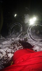
About to crash out - then an odd dream of waiting to start a bike race with some mates, us all lying around in the snow?!
Thawing out an early brekkie, before 5am
Good effort, I struggle to motivate myself enough to get out on a schoolnight!
I was there
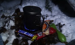
Oh, kit.. 7.3lbs inc bags, lighting and food, plus my std camelback with hipflask, water and tools / spares and a windproof. Beer can stove, 50ml meths.
Time would be better spent getting the miles in instead of fretting about how many ml of meths to carry...
-
InspiredRamblings
- Posts: 362
- Joined: Wed Jan 09, 2013 4:47 pm
- Location: Bath
- Contact:
Re: Bivvy a month for 2013
Finally!
After much faffing in January, February and March, and after one failed attempt in April due to a mechanical, I did finally manage a ride and bivvy on the South Downs last weekend. And it was loverly. Got the train out of London to Shoreham on Sea, headed up the Downs Link Bridleway, turned west onto the South Downs Way and headed up to Chanctonbury Ring for the night. The following morning we retraced our steps back down to the Downs Link and then headed north. The plan was to head to up to Guildford but somehow we ended up in a pub in Horsham for lunch instead.
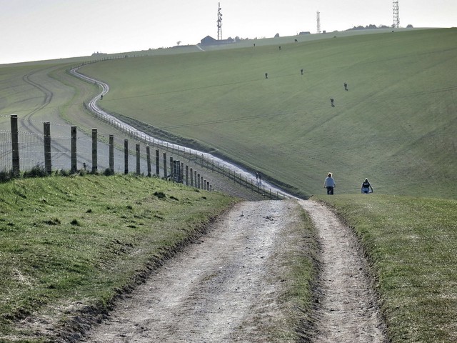
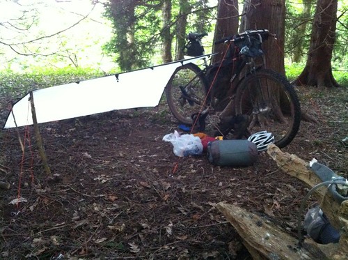
Part of the South Downs Way
First time with the SilTarp 2
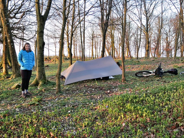
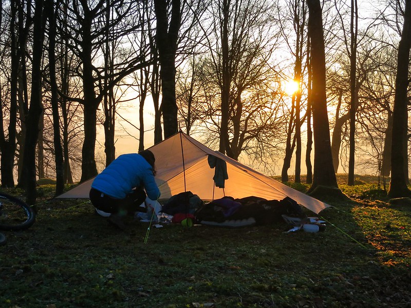
Trees, tarp, bike and friend Anna
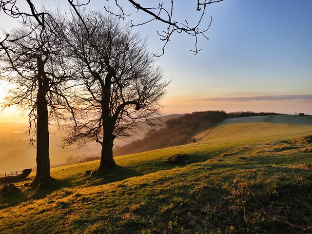
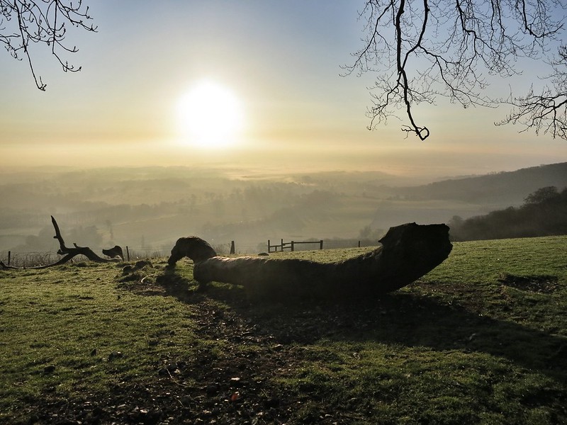
Beautiful morning light.
A little chilly overnight...
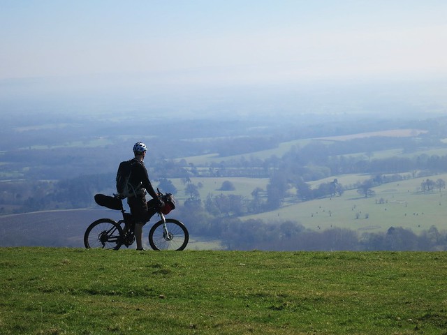
More photos are here.
Heading to the Peak District tomorrow for a three day, two night ride around Edale and Hathersage. Friends are doing it on foot but I'm going to be antisocial and head off on the bike each day, meeting up with them to camp each night
After much faffing in January, February and March, and after one failed attempt in April due to a mechanical, I did finally manage a ride and bivvy on the South Downs last weekend. And it was loverly. Got the train out of London to Shoreham on Sea, headed up the Downs Link Bridleway, turned west onto the South Downs Way and headed up to Chanctonbury Ring for the night. The following morning we retraced our steps back down to the Downs Link and then headed north. The plan was to head to up to Guildford but somehow we ended up in a pub in Horsham for lunch instead.
Part of the South Downs Way
First time with the SilTarp 2
Trees, tarp, bike and friend Anna
Beautiful morning light.
A little chilly overnight...
More photos are here.
Heading to the Peak District tomorrow for a three day, two night ride around Edale and Hathersage. Friends are doing it on foot but I'm going to be antisocial and head off on the bike each day, meeting up with them to camp each night
Re: Bivvy a month for 2013
Some nice pictures there.
-
pushbikemike

- Posts: 559
- Joined: Mon Sep 03, 2012 12:14 pm
- Location: Borders
Re: Bivvy a month for 2013
4/4. April outing was on the 30th. A local outing on cademuir hill. Lovely evening watching sun set and messing about with my new tarp. Its a hennessy hex tarp bought from flatfishy which was very nice. It coped well with the heavy gusts and rain during the night as I slept in my very comy hammock. Am loving hammock bivis. 
Re: Bivvy a month for 2013
Nice pics Chris. Have a good time in the Peak Disctrict. You'll love the riding. Any idea on a route?
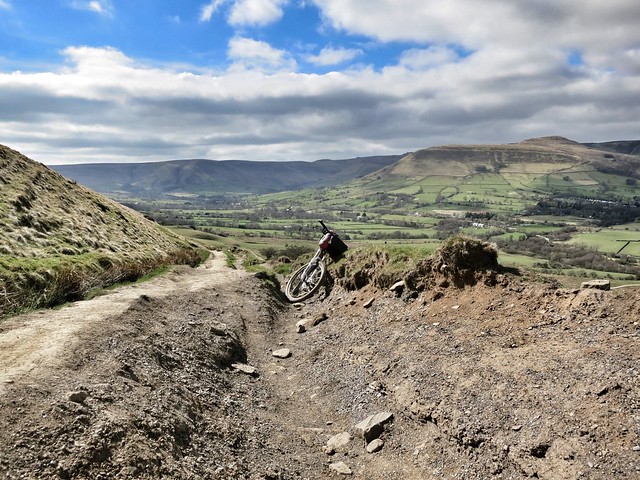
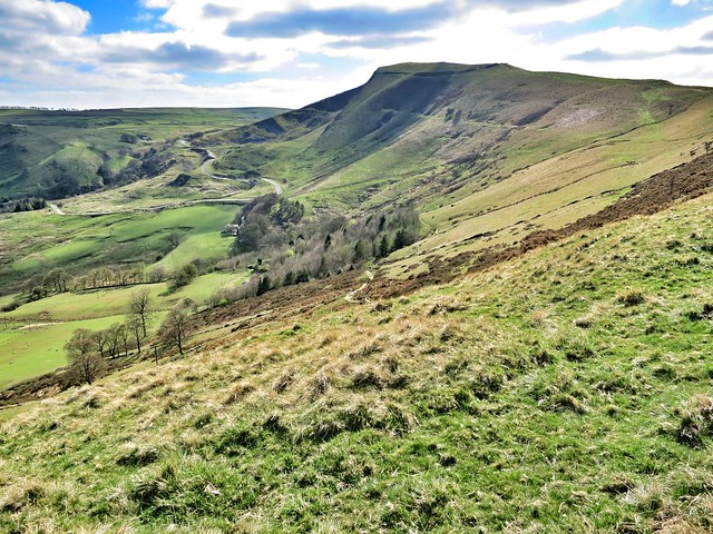
Around Chinley Churn would be a good place to bivvy. There's an old quarry cut into the side of the hill with good views to the East so you'll get a nice sunrise.
Around Chinley Churn would be a good place to bivvy. There's an old quarry cut into the side of the hill with good views to the East so you'll get a nice sunrise.
You Tube:
https://www.youtube.com/channel/UCGYaFH ... mTPePCcCXQ
Instagram: https://www.instagram.com/dk.nwhy/
https://www.youtube.com/channel/UCGYaFH ... mTPePCcCXQ
Instagram: https://www.instagram.com/dk.nwhy/
Re: Bivvy a month for 2013
If you see an overweight guy, with all the gear and no idea, pushing his bike up a hill, then say hello! It'll probably be meInspiredRamblings wrote:Heading to the Peak District tomorrow for a three day, two night ride around Edale and Hathersage. Friends are doing it on foot but I'm going to be antisocial and head off on the bike each day, meeting up with them to camp each night
-
InspiredRamblings
- Posts: 362
- Joined: Wed Jan 09, 2013 4:47 pm
- Location: Bath
- Contact:
Re: Bivvy a month for 2013
As there is quite a large group we're camping at sites rather than wild... So at Edale tonight. Leaving car there. Sat night is near Hathersage with Sunday night at Grindlow. The other guys have some rough walking routes for each day and then back to Edale to pick up the cars on Monday.Dan_K wrote:Any idea on a route?
I only had a proper look at the map yesterday. Apart from the fact the Grindlow is off the bottom of my map (doh!), I've also had a look in my mtb route book and it looks like there's a lot of good riding between those three points. I may just take the relevant pages from the book, buy the missing map sheets and kind of play it by ear.... What can possibly go wrong????
-
InspiredRamblings
- Posts: 362
- Joined: Wed Jan 09, 2013 4:47 pm
- Location: Bath
- Contact:
Re: Bivvy a month for 2013
Cool! Which nights will you be out? Any idea where you'll be headed?Zoglug wrote: Im off to Edale for my first ever bikpacking/bivi trip in preparation for the WRT!
Re: Bivvy a month for 2013
Im heading out there this afternoon on the train. Definitely out tonight and during the day tomorrow, depending how it goes i may squeeze a second camp in. At the moment were a little undecided! Im rather unfit, so am just out to have a good time and get used to all my gear rather than break any records. We will probably end up 'trying' to do Mam Tor, Rushup Edge, into Roych Clough (where ill maybe set up camp depending how im feeling), then Saturday i am honestly not sure just yet, probably just see how we feel!
-
gairym

- Posts: 3151
- Joined: Tue Jan 10, 2012 11:05 am
- Location: Chamonix, France (but a Yorkshire lad).
Re: Bivvy a month for 2013
I'm now 5 for 5 in 2013 although this months effort was bitter-sweet as my nights out were part of my aborted attempt to bikepack across the Pyrenees.
Here's a shot our camp on the first night:

Here's a shot our camp on the first night:
-
InspiredRamblings
- Posts: 362
- Joined: Wed Jan 09, 2013 4:47 pm
- Location: Bath
- Contact:
Re: Bivvy a month for 2013
How did your ride go? I'll post some pics in a while - was a great couple of days although it felt like I'd covered many more miles than it turned out that I actually had...!Zoglug wrote:Im heading out there this afternoon on the train. Definitely out tonight and during the day tomorrow, depending how it goes i may squeeze a second camp in. At the moment were a little undecided! Im rather unfit, so am just out to have a good time and get used to all my gear rather than break any records. We will probably end up 'trying' to do Mam Tor, Rushup Edge, into Roych Clough (where ill maybe set up camp depending how im feeling), then Saturday i am honestly not sure just yet, probably just see how we feel!
-
InspiredRamblings
- Posts: 362
- Joined: Wed Jan 09, 2013 4:47 pm
- Location: Bath
- Contact:
Re: Bivvy a month for 2013
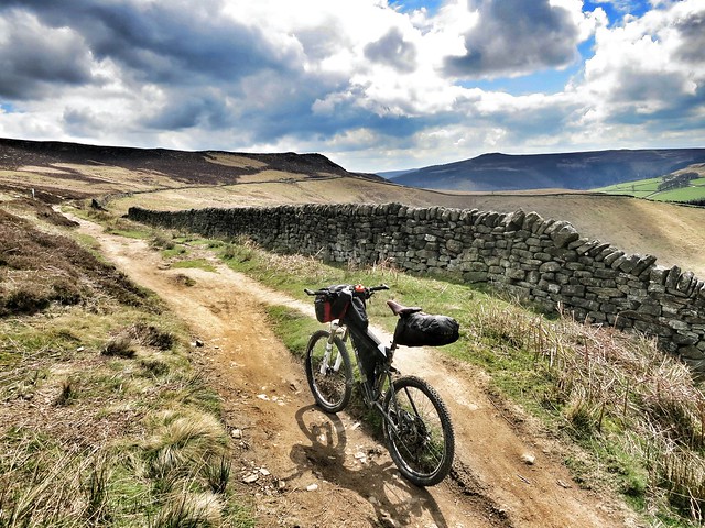
So, I spent last weekend in the Peak District with some friends. Their plan was to spend nights camping at Edale, Hathersage and Grindlow, walking with their gear on the days inbetween, and then heading back to Edale to collect the cars. I thought I'd do it by bike, meeting them in the evening.
Had no idea on bikeable routes really and only managed to pick up a map a few days before. But got a copy of the Peak District Dark Peak Trails Mountain Biking book which is excellent, and with the help of the map, pieced together a couple of days of routes from different sections of the book.
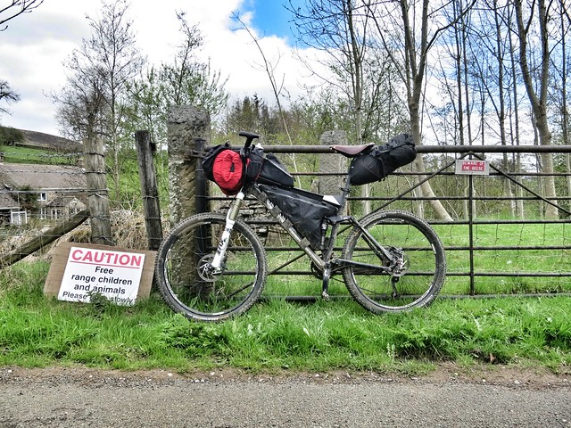
Camped the night in Edale at the Fieldhead Campsite which is attached to the Moorland Info Centre. Left our cars in some farmer's field for a nominal fee as there is no parking for the campsite...
Day 1
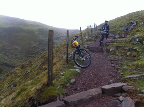
In the morning, I headed out east from Edale along the road, until I picked up a bridleway heading uphill to the north east. This eventually leads up towards Hope Cross. Met a local mountain biker up there with his dog who pointed out 'The Beast' descent straight ahead. I turned left along another bridleway (Roman Road) heading north, and eventually descending down to the A57 Snake Pass.
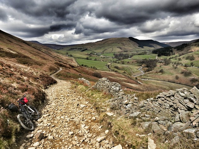
Looking down towards Snake Pass.
Looking back up. Although it looks smooth there, it was all very rocky further up - one rider who passed me on the way down took a spill a bit further on.
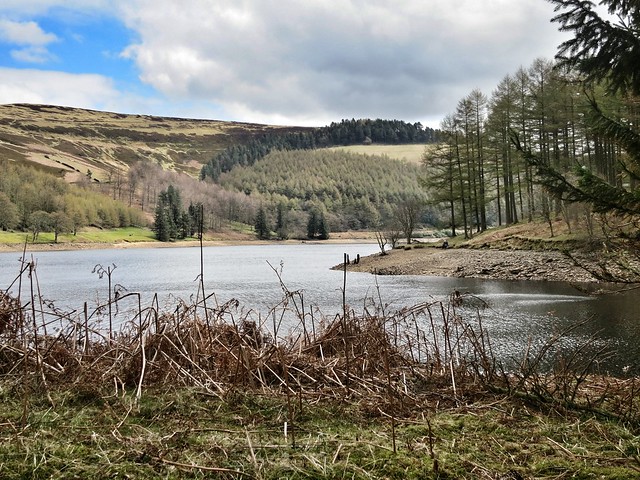
Crossed the A57 and took a track up again, over the next hill and down a steep rocky bridleway to pop out by the little inlet on the west side of Derwent Water for a nice beach lunch.
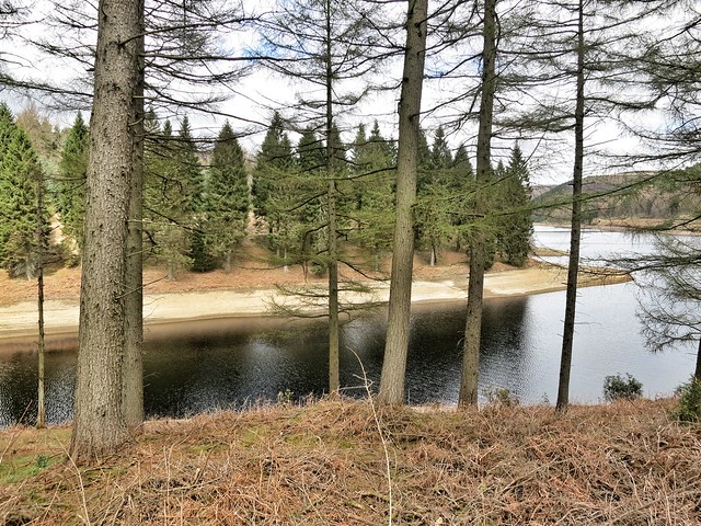
I think this will do nicely.
Headed down on the road, crossed over the dam, headed south again and then picked up a bridleway heading up (flagstones initially!) towards Derwent Edge. I did start to manhandle the bike up off the bridleway that traverses below the Edge towards the top of the ridge but then decided it wasn't worth the effort!
Follow that trail...
Turned north again at Whinstone Lee Tor and along a great bouncy moorland track, doubling back south again and eventually popped out just by the Ladybower Inn. Headed south by road to Bamford and then bridleway to Hathersage in time to pick up some shorts (managed to put a huge hole in the arse of mine) and grab some coffee and cake, before heading back up the hill the few miles out to the North Lees Campsite, which was busy but lovely.
In total about 17 miles.
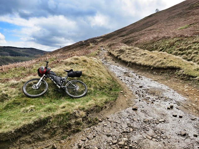
Day 2
Headed off from Hathersage on the B6001 before turning west and heading up towards Highlow Hall and the Offerton Hall.
Beware of them there geese. Fierce, they are.
Here I picked up the Hope Valley Watershed route from the book. Down into Brough and then along to Hope. Northeast up a steep hill to Aston before swinging northwest, skirting the edge of Win Hill, up onto Hope Brink (this section felt hard going), eventually leading to Hope Cross (again!). Followed my route up from Edale the previous day in reverse, and ended up having a little bite to eat and refilling my water back in the Fieldhead campsite! Then crossed the road and headed up towards Hollins Cross, to the south of Edale.
There may have been some pushing.
Mam Tor, from Hollins Cross.
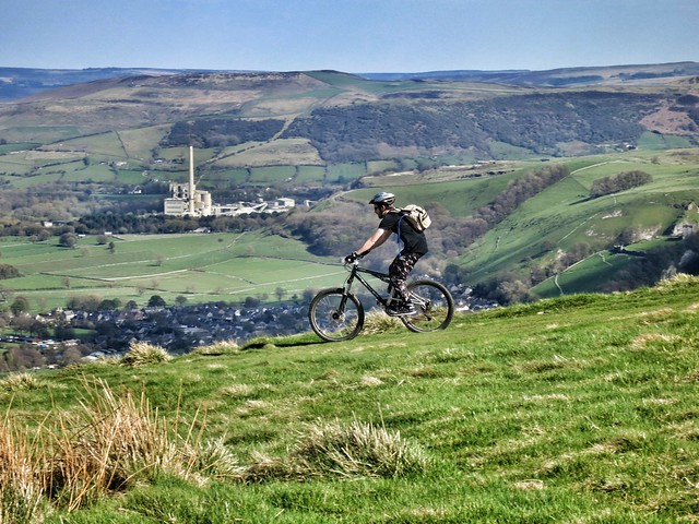
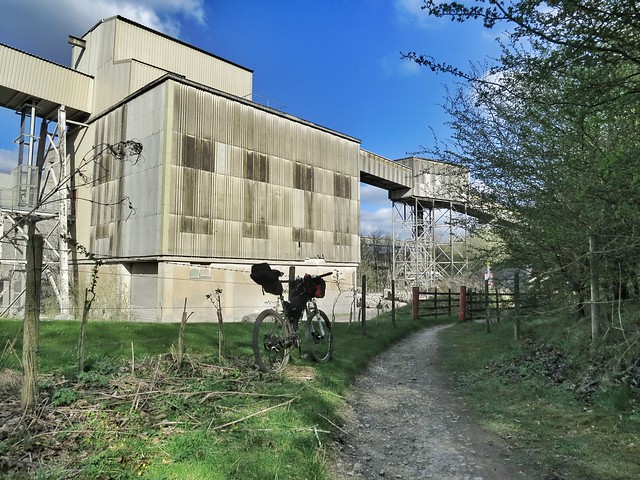
A nicely unladen rider, and quarry infrastructure in the distance, south of Castleton.
Skirted the northern edge of Mam Tor before heading south over the col and then down through a bunch of disused quarries, many of which have been filled in.
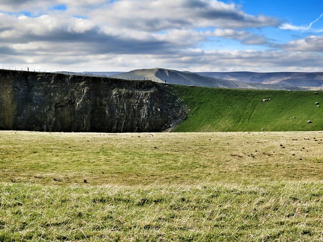
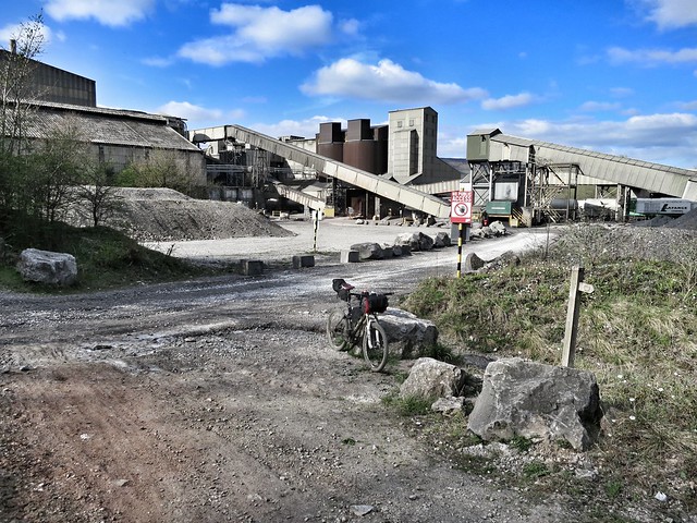
Restored quarry with Mam Tor in the background.
Then down a rocky quarry road and a choice of two descents - Cave Dale, which apparently needs full on trials skills (no chance) or Pin Dale, which was still pretty steep, rocky and sketchy! At the bottom a bridleway takes you literally through the belly of the quarry works you could see from Mam Tor... madness...into Bradwell village.
Here I peeled off and headed south through Great Hucklow to Grindlow to the campsite. Was pretty weary, very sweaty and not happy that there was no shower! But food in the amazing pub in Foolow made up for that. As did the Shetland Ponies at the campsite...
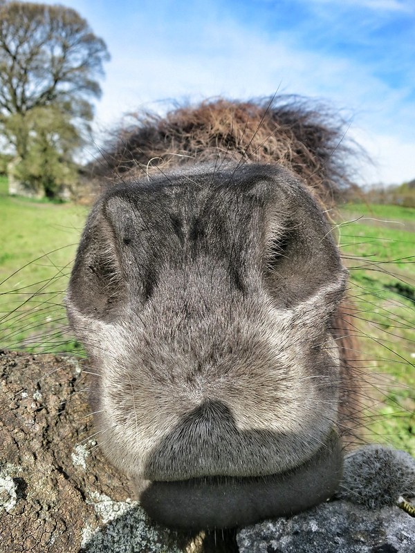
He was quite friendly.
In total about 21 miles.
Day 3
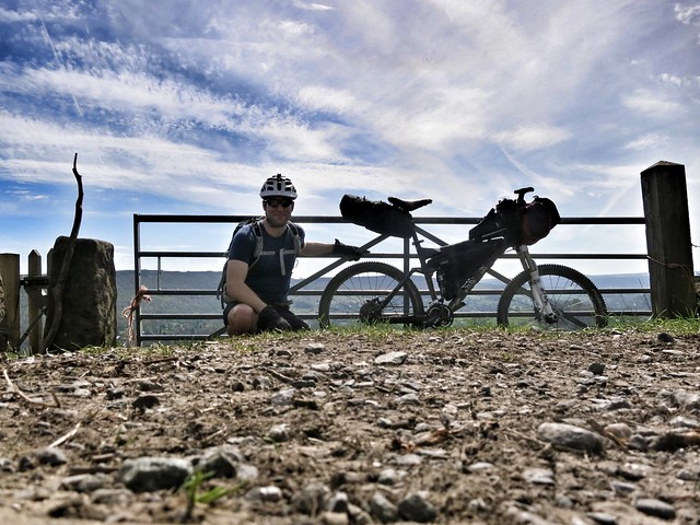
Was feeling a little worried about getting back to London before the Bank Holiday rush and a few of the walkers were suffering with blisters after a couple of 16 mile days. So rather than riding back to Edale I skirted along east towards Hathersage for lunch and to then catch the 15 min train to Edale. This was a pretty ride although being back on the roads really wasn't.
The rough routes are here: Day 1 and Day 2.
I was using a Spot tracker on tracking mode to record the route. This logs your position every ten minutes. When I grabbed the file from the Spot website and popped it into Strava, the fact that the position is only recorded every ten minutes seems to affect the stats - for example it thinks I only rode for about an hour out of a six hour day, used 15 calories and climbed 270 ft! I suspect it also reduced the mileage fairly significantly, as its just measuring straightline distances between each point, and not much that I rode on was in a straight line. Be interested to see if I can use the Spot data a bit better somehow. The benefits of the Spot (apart from the SOS feature) over a Garmin etc is battery life - my EDGE will only last a day or two whereas the Spot will last for a few weeks...
Full photoset here.
Anyway, these days felt pretty good - makes me question how much distance I can really get done on the WRT thing though...!
Had no idea on bikeable routes really and only managed to pick up a map a few days before. But got a copy of the Peak District Dark Peak Trails Mountain Biking book which is excellent, and with the help of the map, pieced together a couple of days of routes from different sections of the book.
Camped the night in Edale at the Fieldhead Campsite which is attached to the Moorland Info Centre. Left our cars in some farmer's field for a nominal fee as there is no parking for the campsite...
Day 1
In the morning, I headed out east from Edale along the road, until I picked up a bridleway heading uphill to the north east. This eventually leads up towards Hope Cross. Met a local mountain biker up there with his dog who pointed out 'The Beast' descent straight ahead. I turned left along another bridleway (Roman Road) heading north, and eventually descending down to the A57 Snake Pass.
Looking down towards Snake Pass.
Looking back up. Although it looks smooth there, it was all very rocky further up - one rider who passed me on the way down took a spill a bit further on.
Crossed the A57 and took a track up again, over the next hill and down a steep rocky bridleway to pop out by the little inlet on the west side of Derwent Water for a nice beach lunch.
I think this will do nicely.
Headed down on the road, crossed over the dam, headed south again and then picked up a bridleway heading up (flagstones initially!) towards Derwent Edge. I did start to manhandle the bike up off the bridleway that traverses below the Edge towards the top of the ridge but then decided it wasn't worth the effort!
Follow that trail...
Turned north again at Whinstone Lee Tor and along a great bouncy moorland track, doubling back south again and eventually popped out just by the Ladybower Inn. Headed south by road to Bamford and then bridleway to Hathersage in time to pick up some shorts (managed to put a huge hole in the arse of mine) and grab some coffee and cake, before heading back up the hill the few miles out to the North Lees Campsite, which was busy but lovely.
In total about 17 miles.
Day 2
Headed off from Hathersage on the B6001 before turning west and heading up towards Highlow Hall and the Offerton Hall.
Beware of them there geese. Fierce, they are.
Here I picked up the Hope Valley Watershed route from the book. Down into Brough and then along to Hope. Northeast up a steep hill to Aston before swinging northwest, skirting the edge of Win Hill, up onto Hope Brink (this section felt hard going), eventually leading to Hope Cross (again!). Followed my route up from Edale the previous day in reverse, and ended up having a little bite to eat and refilling my water back in the Fieldhead campsite! Then crossed the road and headed up towards Hollins Cross, to the south of Edale.
There may have been some pushing.
Mam Tor, from Hollins Cross.
A nicely unladen rider, and quarry infrastructure in the distance, south of Castleton.
Skirted the northern edge of Mam Tor before heading south over the col and then down through a bunch of disused quarries, many of which have been filled in.
Restored quarry with Mam Tor in the background.
Then down a rocky quarry road and a choice of two descents - Cave Dale, which apparently needs full on trials skills (no chance) or Pin Dale, which was still pretty steep, rocky and sketchy! At the bottom a bridleway takes you literally through the belly of the quarry works you could see from Mam Tor... madness...into Bradwell village.
Here I peeled off and headed south through Great Hucklow to Grindlow to the campsite. Was pretty weary, very sweaty and not happy that there was no shower! But food in the amazing pub in Foolow made up for that. As did the Shetland Ponies at the campsite...
He was quite friendly.
In total about 21 miles.
Day 3
Was feeling a little worried about getting back to London before the Bank Holiday rush and a few of the walkers were suffering with blisters after a couple of 16 mile days. So rather than riding back to Edale I skirted along east towards Hathersage for lunch and to then catch the 15 min train to Edale. This was a pretty ride although being back on the roads really wasn't.
The rough routes are here: Day 1 and Day 2.
I was using a Spot tracker on tracking mode to record the route. This logs your position every ten minutes. When I grabbed the file from the Spot website and popped it into Strava, the fact that the position is only recorded every ten minutes seems to affect the stats - for example it thinks I only rode for about an hour out of a six hour day, used 15 calories and climbed 270 ft! I suspect it also reduced the mileage fairly significantly, as its just measuring straightline distances between each point, and not much that I rode on was in a straight line. Be interested to see if I can use the Spot data a bit better somehow. The benefits of the Spot (apart from the SOS feature) over a Garmin etc is battery life - my EDGE will only last a day or two whereas the Spot will last for a few weeks...
Full photoset here.
Anyway, these days felt pretty good - makes me question how much distance I can really get done on the WRT thing though...!
-
ScotRoutes
- Posts: 8144
- Joined: Mon Mar 18, 2013 9:56 am
Re: Bivvy a month for 2013
4/5, or 5 in 5 if sneaking into an unlocked pump house near the dam in the Black Mountains counts as a bivi.. 'hobo living' maybe, bivi maybe not. But when it's that wet, found shelter trumps a tarp bivi!
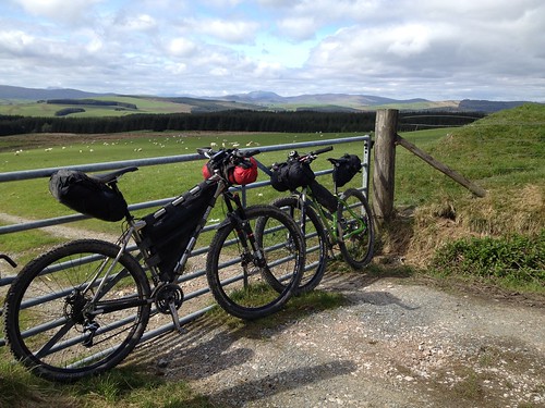
I got 5 days riding in by riding back to Swindon from home via the Ridgeway on thursday followed by the train to start a 4 day ride between Stroud and the Black Mountains with the Forest of Dean and Monmouth area woods on the return. Wet at times, we had to bail off the hill tops fast on Saturday afternoon in the face of freezing sleet and high winds but we found some great trails by not planning the route too much, just riding and exploring the way we like to. 9-12hrs a day with a lunch stop so we covered a fair amount of ground and certainly learned a bit more about wet weather bikepacking.. and the Verderer's trail in the FOD is fun on a loaded bike : ) bikepacker airtime!
My bivi in roadside woodland, night 3.
Black Mtns descent - the water-drain steps were either nice little fly-offs or rim-smashers waiting to happen.
inspiredramblings, great pics from the SDW.
Re: Bivvy a month for 2013
InspiredRamblings, that trip looks fantastic well done, I was hoping to see a report after ur post about where to go in Peaks.
The descent off W.L.Tor down to Ladybower Inn is one of my all time fav's. Even fully loaded it doesn't loose that fast swoopy jumpy magic! And yup, the rocky trail down to the A57 is indeed known as Potato Alley The Beast, altho far more technical is actually my preferred way down off that hill.
The descent off W.L.Tor down to Ladybower Inn is one of my all time fav's. Even fully loaded it doesn't loose that fast swoopy jumpy magic! And yup, the rocky trail down to the A57 is indeed known as Potato Alley
-
InspiredRamblings
- Posts: 362
- Joined: Wed Jan 09, 2013 4:47 pm
- Location: Bath
- Contact:
Re: Bivvy a month for 2013
Cheers! Despite the fact that we weren't up stupidly early and we were done by 5 or 6, I'm a bit disappointed that the distances were so short - it felt like further! But some may have been lost in the way the Spot data has been used. The Beast sounded slightly manic so I thought better of it on my loaded xc bike... Maybe it would have been fine though?Anthony wrote:InspiredRamblings, that trip looks fantastic well done, I was hoping to see a report after ur post about where to go in Peaks.
The descent off W.L.Tor down to Ladybower Inn is one of my all time fav's. Even fully loaded it doesn't loose that fast swoopy jumpy magic! And yup, the rocky trail down to the A57 is indeed known as Potato Alley
Re: Bivvy a month for 2013
5/5 with the WRT
Glorious weather and a good chance to test out some important pieces of kit (new saddle)
I'd post some pictures, but flickr have messed about with there interface
Glorious weather and a good chance to test out some important pieces of kit (new saddle)
I'd post some pictures, but flickr have messed about with there interface
Re: Bivvy a month for 2013
WRT was 5/5 for me too.
And I'm out tonight, in the inhospitable lands of Buckinghamshire.
And I'm out tonight, in the inhospitable lands of Buckinghamshire.
-
99percentchimp

- Posts: 1057
- Joined: Sat Jun 25, 2011 7:46 pm
- Location: North Wales!
Re: Bivvy a month for 2013
Gonna be a last minute one for me this month too!! Been a busy month but Friday night it is!
Conquistador of the pointless
https://www.flickr.com/photos/99percentchimp/
https://www.flickr.com/photos/99percentchimp/
-
pushbikemike
- Posts: 559
- Joined: Mon Sep 03, 2012 12:14 pm
- Location: Borders
Re: Bivvy a month for 2013
5/5 at WRT for me too. Cracking trip. Some photos on the WRT photo thread.
-
gairym
- Posts: 3151
- Joined: Tue Jan 10, 2012 11:05 am
- Location: Chamonix, France (but a Yorkshire lad).
Re: Bivvy a month for 2013
I'm hoping that June has at least a few dry nights in it as it's not stopped raining here since we've been back (and was apparently raining the entire time we were back in the UK too!).
They (the locals) are saying it's been the wettest May in 30 years here!
I might see if maybe this weekend I could sneak in a little trip....? We'll see.
They (the locals) are saying it's been the wettest May in 30 years here!
I might see if maybe this weekend I could sneak in a little trip....? We'll see.
-
99percentchimp
- Posts: 1057
- Joined: Sat Jun 25, 2011 7:46 pm
- Location: North Wales!
Re: Bivvy a month for 2013
Only just this month, 5/5 for the year so far.. last minute yomp round Clogcaenog with Jason inspired by JohnClimber of this parish (thanks for the GPX ages ago John :) ).
Distant views by 99percentchimp, on Flickr
Distant views by 99percentchimp, on Flickr
Conquistador of the pointless
https://www.flickr.com/photos/99percentchimp/
https://www.flickr.com/photos/99percentchimp/

Re: Bivvy a month for 2013
inspiredramblings have u got a gpx of ur peaks route i could nick please i like the sound of ur trip and its been ages since ive rode the peaks!! cheers