Borders 350. 2015 Final Route and Details.
Posted: Mon Aug 03, 2015 10:16 am
Borders 350 ITT.
Group Start. Saturday 29 Aug 2015, 9AM.
Start/Finish. Peebles, Scottish Borders.
Max 50 Riders.
Distance. 335 miles according to Bikehike, 360 miles according to Viewranger.
Height Gain. 11,694 metres (38,366 feet) according to bikehike.
GPX (amended) - http://www.mapmyrun.com/routes/view/842311237
http://www.mapmyrun.com/routes/view/803950841
http://www.mapmyrun.com/routes/view/803951677
If you would like to enter the group start then please send me your name to borders350ittATgmailDOTcom and I will enter you and email the route gpx to you. If you have already entered then the route will be on it's way tonight.
If you would just like the gpx route sent from me then email me at youngray50ATgmailDOTcom
To avoid any confusion delete any previous route incarnations before downloading the final one, it is in three parts, Borders3501/3, Borders3502/3 and Borders3503/3.
Bothies (miles by viewranger).
89 miles Over Phawhope NT 181081 on route.
123 miles Greensykes NT312000 200 metres off route.
135 miles Unknown bothy approx NY344977 a mobile home done out with bunks, not locked, on route.
193 miles Spithope NY768056 on route.
200 miles Yearning Saddle Refuge Hut NT804129 on route.
354 miles, Minch Moor NT342337 on route (hardly worth it, your nearly finished).
Some route info-
The climb from Megget Reservoir to NT180265 is marked as a path but is in fact land rover track and all rideable, even loaded. It has been extended beyond what is seen on satellite imagery. Come off at the point where it starts to bear hard left near the top, turn off to the right at a small pile of stones. You are aiming for a gate at a fence corner which you can't see and are immediately confronted by an area of bog, easiest way round is to keep skirting to the right.
The descent back down this climb is potentially very fast but bear in mind that slower riders may still be coming up so please slow down on the few corners that you can't see round.
The climb from Fruid Reservoir NT099182 to Spout Craig NT083138 is bikehike. Don't be tempted from the gpx track by quad bike tracks, they will only lead you astray and disappear just as quickly as they appear.
Facilities on route (miles by viewranger).
18.5 miles NT241205 Tibbie Shiels Inn, may not be open through the day.
19 miles NT237204 roadside cafe.
42 miles Broughton, shop, garage, posh looking Bistro.
79 miles Moffat, shops, pubs doing food, cafes, take away's (the Indian restaurant/take away does pizza).
155 miles Newcastleton, shop, pubs doing food.
176 miles Kielder, shop, pub doing food, cafe, campsite.
190 miles Byrness, Youth Hostel, Hotel.
217 miles Kirk Yetholm, pub (probably does food).
233 miles Wooler, shops, pubs doing food, cafes, take away's, campsites (don't use the big one with the mobile homes, it costs a fortune).
261 miles 1 to 1.5 miles off route each way, Alwinton, pub doing food, campsite.
318 miles Jedburgh, shops, pubs doing food, cafes, take away's.
331 miles Hawick, shops, pubs doing food, cafes, take away's.
344 miles Selkirk, shops, pubs doing food, cafes, take away's.
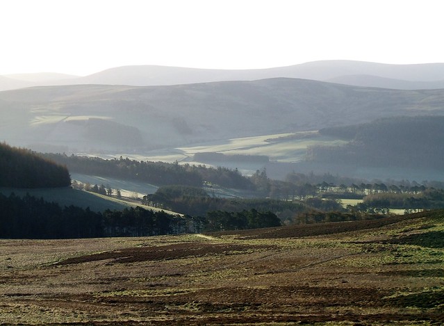
 Borders 003 by youngray50, on Flickr
 Borders 005 by youngray50, on Flickr
 3 days in The Borders 023 by youngray50, on Flickr
 3 days in The Borders 029 by youngray50, on Flickr
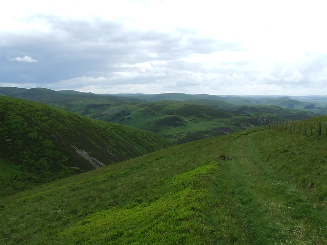
 Broughton Heights 006 by youngray50, on Flickr
 3 days in The Borders 028 by youngray50, on Flickr
 3 days in The Borders 026 by youngray50, on Flickr
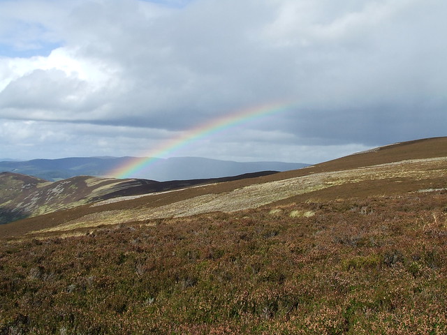
 cheviots 013 by youngray50, on Flickr
 cheviots 016 by youngray50, on Flickr
 3 days in The Borders 006 by youngray50, on Flickr
 3 days in The Borders 015 by youngray50, on Flickr
Group Start. Saturday 29 Aug 2015, 9AM.
Start/Finish. Peebles, Scottish Borders.
Max 50 Riders.
Distance. 335 miles according to Bikehike, 360 miles according to Viewranger.
Height Gain. 11,694 metres (38,366 feet) according to bikehike.
GPX (amended) - http://www.mapmyrun.com/routes/view/842311237
http://www.mapmyrun.com/routes/view/803950841
http://www.mapmyrun.com/routes/view/803951677
If you would like to enter the group start then please send me your name to borders350ittATgmailDOTcom and I will enter you and email the route gpx to you. If you have already entered then the route will be on it's way tonight.
If you would just like the gpx route sent from me then email me at youngray50ATgmailDOTcom
To avoid any confusion delete any previous route incarnations before downloading the final one, it is in three parts, Borders3501/3, Borders3502/3 and Borders3503/3.
Bothies (miles by viewranger).
89 miles Over Phawhope NT 181081 on route.
123 miles Greensykes NT312000 200 metres off route.
135 miles Unknown bothy approx NY344977 a mobile home done out with bunks, not locked, on route.
193 miles Spithope NY768056 on route.
200 miles Yearning Saddle Refuge Hut NT804129 on route.
354 miles, Minch Moor NT342337 on route (hardly worth it, your nearly finished).
Some route info-
The climb from Megget Reservoir to NT180265 is marked as a path but is in fact land rover track and all rideable, even loaded. It has been extended beyond what is seen on satellite imagery. Come off at the point where it starts to bear hard left near the top, turn off to the right at a small pile of stones. You are aiming for a gate at a fence corner which you can't see and are immediately confronted by an area of bog, easiest way round is to keep skirting to the right.
The descent back down this climb is potentially very fast but bear in mind that slower riders may still be coming up so please slow down on the few corners that you can't see round.
The climb from Fruid Reservoir NT099182 to Spout Craig NT083138 is bikehike. Don't be tempted from the gpx track by quad bike tracks, they will only lead you astray and disappear just as quickly as they appear.
Facilities on route (miles by viewranger).
18.5 miles NT241205 Tibbie Shiels Inn, may not be open through the day.
19 miles NT237204 roadside cafe.
42 miles Broughton, shop, garage, posh looking Bistro.
79 miles Moffat, shops, pubs doing food, cafes, take away's (the Indian restaurant/take away does pizza).
155 miles Newcastleton, shop, pubs doing food.
176 miles Kielder, shop, pub doing food, cafe, campsite.
190 miles Byrness, Youth Hostel, Hotel.
217 miles Kirk Yetholm, pub (probably does food).
233 miles Wooler, shops, pubs doing food, cafes, take away's, campsites (don't use the big one with the mobile homes, it costs a fortune).
261 miles 1 to 1.5 miles off route each way, Alwinton, pub doing food, campsite.
318 miles Jedburgh, shops, pubs doing food, cafes, take away's.
331 miles Hawick, shops, pubs doing food, cafes, take away's.
344 miles Selkirk, shops, pubs doing food, cafes, take away's.
Borders 003 by youngray50, on FlickrBorders 005 by youngray50, on Flickr3 days in The Borders 023 by youngray50, on Flickr3 days in The Borders 029 by youngray50, on FlickrBroughton Heights 006 by youngray50, on Flickr3 days in The Borders 028 by youngray50, on Flickr3 days in The Borders 026 by youngray50, on Flickrcheviots 013 by youngray50, on Flickrcheviots 016 by youngray50, on Flickr3 days in The Borders 006 by youngray50, on Flickr3 days in The Borders 015 by youngray50, on Flickr